Ikalamavony geodata
Ikalamavony (Upper Matsiatra) is a populated place; located in Madagascar in Indian/Antananarivo (GMT+3) time zone. With population of 15,601 people, there are 83 cities with bigger population in this country. Compared to other cities in Madagascar, 68.3% of cities are located further ↑North; 75.6% of cities are located further →East and 65.9% of cities have lower elevation than Ikalamavony. Note1
Administrative division(s):
- Level 1: Upper Matsiatra
- Level 2: Ikalamavony
- Level 3: Ikalamavony
- Level 4: Manorikandro


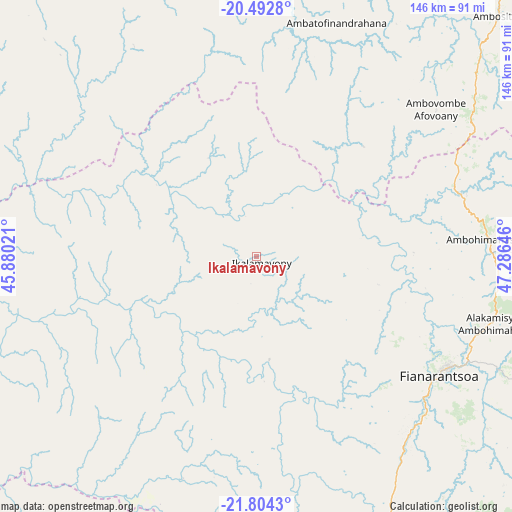
Ikalamavony GPS coordinates[2]
21° 9' 0" South, 46° 34' 59.988" East
| Map corner | latitude | longitude |
|---|---|---|
| Upper-left | -20.4928°, | 45.88021° |
| Center: | -21.15°, | 46.58333° |
| Lower-right: | -21.8043°, | 47.28646° |
| Map W x H: | 145.8×145.8 km | = 90.6×90.6mi |
| max Lat: | -12.31732° ⇑68.3% North |
| Ikalamavony: | -21.15° |
| min Lat: | ⇓31.7% South -25.3° |
| min Long | Ikalamavony | max Long |
| 43.65° | 46.58333° | 50.27876° |
| W 24.4%⇐ | ⇒75.6% E |
Elevation
Elevation of Ikalamavony is 818 m = 2684 ft, and this is 260.6 m = 855 ft above average elevation for this country.
| Max E: |
1763 m = 5784 ft | 34.1% |
| Ikalamavony | 818 m 2684 ft | |
| Avg. | 557.4 m = 1829 ft | |
Min E: |
1 m = 3 ft | 65.9% |
See also: Madagascar elevation on elevation.city.
Geographical zone
Ikalamavony is located in South Torrid zone (between Equator and Tropic of Capricorn). Distance of this Southern Tropic circle is 254.3 km =158 mi to South.| Distance of | km | miles | from Ikalamavony |
|---|---|---|---|
| Equator | 2351.7 | 1461.3 | to North |
| Tropic Capricorn | 254.3 | 158 | to South |
| Antarctic Circle | 5049.5 | 3137.6 | to South |
| South Pole | 7655.4 | 4756.8 | to South |


Nearby cities:
15 places around Ikalamavony: (largest is in red/bold)
• Ambalavao
84.2 km =52.3 mi,  154°
154°
• Ambatofinandrahana
70.2 km =43.6 mi,  19°
19°
• Amboanjo
161.5 km =100.4 mi,  125°
125°
• Ambositra
97.2 km =60.4 mi,  44°
44°
• Antsirabe
150.3 km =93.4 mi, 18°
• Beroroha
157.5 km =97.9 mi,  248°
248°
• Betafo
149 km =92.6 mi,  10°
10°
• Fandrandava
80.2 km =49.8 mi,  120°
120°
• Fandriana
131.6 km =81.8 mi, 39°
• Fianarantsoa
62 km =38.5 mi, 122°
• Ifanadiana
110.1 km =68.4 mi,  98°
98°
• Ihosy
147.1 km =91.4 mi,  198°
198°
• Ikongo
119.9 km =74.5 mi, 132°
• Soanindrariny
154.6 km =96.1 mi,  25°
25°
• Vohimanitra
130.8 km =81.3 mi, 117°
Sources, notices
• [Note1] Compared only with cities in Madagascar existing in our database
• [Src1] Map data: © OpenStreetMap contributors (CC-BY-SA)
• [Src2] Other city data from geonames.org with taken over terms of usage.
• [Src3] Geographical zone / Annual Mean Temperature by Robert A. Rohde @ Wikipedia
