Ambalavao geodata
Ambalavao (Upper Matsiatra) is a populated place; located in Madagascar in Indian/Antananarivo (GMT+3) time zone. With population of 28,027 people, there are 37 cities with bigger population in this country. Compared to other cities in Madagascar, 74.8% of cities are located further ↑North; 68.3% of cities are located further →East and 71.5% of cities have lower elevation than Ambalavao. Note1
Administrative division(s):
- Level 1: Upper Matsiatra
- Level 2: Ambalavao
- Level 3: Ambalavao
- Level 4: Ambohijafy


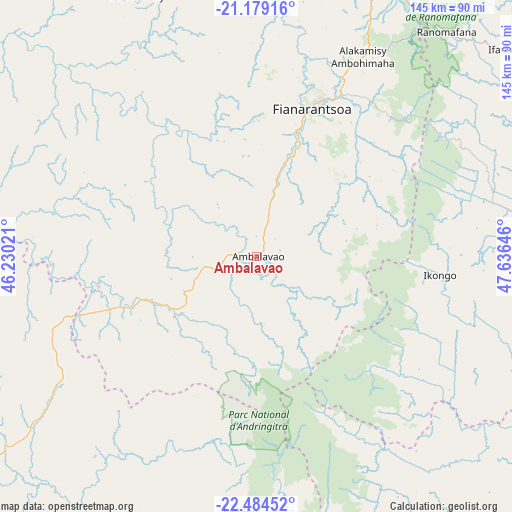
Ambalavao GPS coordinates[2]
21° 49' 59.988" South, 46° 55' 59.988" East
| Map corner | latitude | longitude |
|---|---|---|
| Upper-left | -21.17916°, | 46.23021° |
| Center: | -21.83333°, | 46.93333° |
| Lower-right: | -22.48452°, | 47.63646° |
| Map W x H: | 145.1×145.1 km | = 90.2×90.2mi |
| max Lat: | -12.31732° ⇑74.8% North |
| Ambalavao: | -21.83333° |
| min Lat: | ⇓25.2% South -25.3° |
| min Long | Ambalavao | max Long |
| 43.65° | 46.93333° | 50.27876° |
| W 31.7%⇐ | ⇒68.3% E |
Elevation
Elevation of Ambalavao is 1009 m = 3310 ft, and this is 451.6 m = 1482 ft above average elevation for this country.
| Max E: |
1763 m = 5784 ft | 28.5% |
| Ambalavao | 1009 m 3310 ft | |
| Avg. | 557.4 m = 1829 ft | |
Min E: |
1 m = 3 ft | 71.5% |
See also: Madagascar elevation on elevation.city.
Geographical zone
Ambalavao is located in South Torrid zone (between Equator and Tropic of Capricorn). Distance of this Southern Tropic circle is 178.3 km =110.8 mi to South.| Distance of | km | miles | from Ambalavao |
|---|---|---|---|
| Equator | 2427.6 | 1508.4 | to North |
| Tropic Capricorn | 178.3 | 110.8 | to South |
| Antarctic Circle | 4973.5 | 3090.4 | to South |
| South Pole | 7579.4 | 4709.6 | to South |


Nearby cities:
15 places around Ambalavao: (largest is in red/bold)
• Ambatofinandrahana
143 km =88.9 mi,  354°
354°
• Amboanjo
96.4 km =59.9 mi,  101°
101°
• Anandravy
126.7 km =78.7 mi,  159°
159°
• Fandrandava
48.1 km =29.9 mi,  42°
42°
• Fianarantsoa
45.2 km =28.1 mi,  20°
20°
• Ifanadiana
93.6 km =58.2 mi,  50°
50°
• Ifatsy
105.1 km =65.3 mi,  126°
126°
• Ihosy
104.6 km =65 mi,  232°
232°
• Ikalamavony
84.2 km =52.3 mi,  334°
334°
• Ikongo
51.9 km =32.2 mi, 96°
• Manakara
116.5 km =72.4 mi,  107°
107°
• Manato
84.7 km =52.6 mi,  138°
138°
• Savana
116.9 km =72.6 mi,  121°
121°
• Vohimanitra
80.5 km =50 mi,  79°
79°
• Vondrozo
115.1 km =71.5 mi, 161°
Sources, notices
• [Note1] Compared only with cities in Madagascar existing in our database
• [Src1] Map data: © OpenStreetMap contributors (CC-BY-SA)
• [Src2] Other city data from geonames.org with taken over terms of usage.
• [Src3] Geographical zone / Annual Mean Temperature by Robert A. Rohde @ Wikipedia
