Selenge geodata
Selenge (Hövsgöl) is a seat of a second-order administrative division; located in Mongolia in Asia/Ulaanbaatar (GMT+8) time zone. In our database, there are 33 cities with bigger population. Compared to other cities in Mongolia, 85.6% of cities are located further ↓South; 56.7% of cities are located further →East and 79.1% of cities have higher elevation than Selenge. Note1


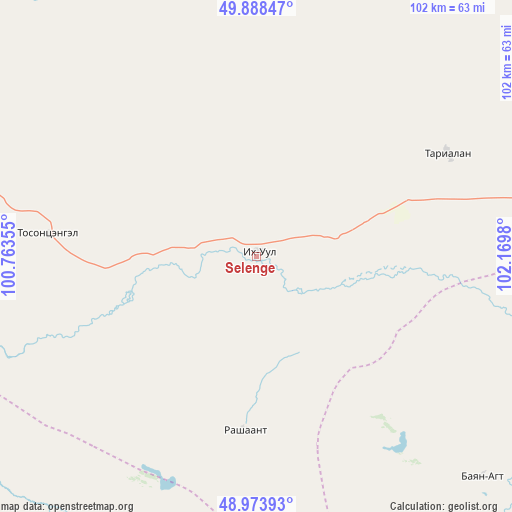
Selenge GPS coordinates[2]
49° 25' 59.988" North, 101° 28' 0.012" East
| Map corner | latitude | longitude |
|---|---|---|
| Upper-left | 49.88847°, | 100.76355° |
| Center: | 49.43333°, | 101.46667° |
| Lower-right: | 48.97393°, | 102.1698° |
| Map W x H: | 101.7×101.7 km | = 63.2×63.2mi |
| max Lat: | 51.50725° ⇑14.4% North |
| Selenge: | 49.43333° |
| min Lat: | ⇓85.6% South 42.84199° |
| min Long | Selenge | max Long |
| 89.14358° | 101.46667° | 118.51014° |
| W 43.3%⇐ | ⇒56.7% E |
Elevation
Elevation of Selenge is 1053 m = 3455 ft, and this is 363.5 m = 1193 ft below average elevation for this country.
| Max E: |
2800 m = 9186 ft | 79.1% |
| Avg. | 1416.5 m = 4647 ft | |
| Selenge | 1053 m = 3455 ft | |
Min E: |
619 m = 2031 ft | 20.9% |
See also: Mongolia elevation on elevation.city.
Geographical zone
Selenge is located in North temperate zone (between Tropic of Cancer and the Arctic Circle). Distance of this North polar circle is 1904.7 km =1183.5 mi to North.| Distance of | km | miles | from Selenge |
|---|---|---|---|
| North Pole | 4510.6 | 2802.8 | to North |
| Arctic Circle | 1904.7 | 1183.5 | to North |
| Tropic Cancer | 2890.6 | 1796.1 | to South |
| Equator | 5496.5 | 3415.4 | to South |


Nearby cities:
15 places around Selenge: (largest is in red/bold)
• Badrah
43 km =26.7 mi,  61°
61°
• Bayantsagaan
93.5 km =58.1 mi,  213°
213°
• Bulag
76.8 km =47.7 mi,  308°
308°
• Eg-Uur
75.6 km =47 mi,  5°
5°
• Hujirt
63.5 km =39.5 mi,  195°
195°
• Hutag
88.8 km =55.2 mi,  92°
92°
• Hüremt
120.1 km =74.6 mi,  135°
135°
• Jargalant
88.9 km =55.2 mi,  260°
260°
• Murun-kuren
96.7 km =60.1 mi,  283°
283°
• Rashaant
34.2 km =21.3 mi,  184°
184°
• Sharga
62.7 km =39 mi,  133°
133°
• Teshig
103.2 km =64.1 mi, 56°
• Tsengel
42 km =26.1 mi, 276°
• Uubulan
97.8 km =60.8 mi,  159°
159°
• Öldziyt
100.8 km =62.6 mi, 183°
Sources, notices
• [Note1] Compared only with cities in Mongolia existing in our database
• [Src1] Map data: © OpenStreetMap contributors (CC-BY-SA)
• [Src2] Other city data from geonames.org with taken over terms of usage.
• [Src3] Geographical zone / Annual Mean Temperature by Robert A. Rohde @ Wikipedia
