Sharga geodata
Sharga (Bulgan) is a seat of a second-order administrative division; located in Mongolia in Asia/Ulaanbaatar (GMT+8) time zone. In our database, there are 33 cities with bigger population. Compared to other cities in Mongolia, 77.9% of cities are located further ↓South; 54% of cities are located further →East and 63.5% of cities have lower elevation than Sharga. Note1


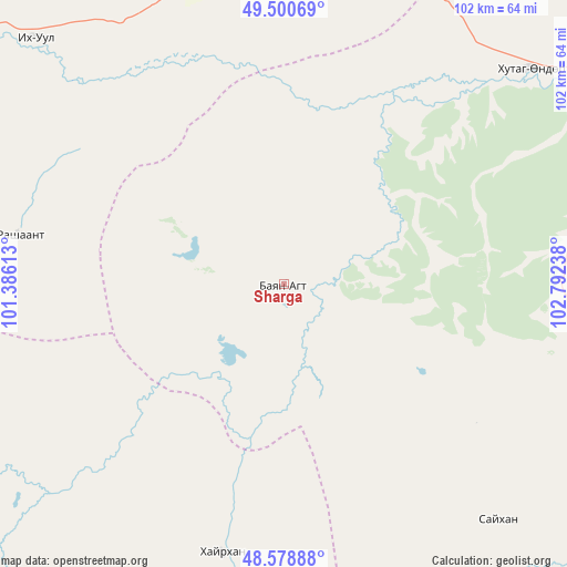
Sharga GPS coordinates[2]
49° 2' 30.912" North, 102° 5' 21.3" East
| Map corner | latitude | longitude |
|---|---|---|
| Upper-left | 49.50069°, | 101.38613° |
| Center: | 49.04192°, | 102.08925° |
| Lower-right: | 48.57888°, | 102.79238° |
| Map W x H: | 102.5×102.5 km | = 63.7×63.7mi |
| max Lat: | 51.50725° ⇑22.1% North |
| Sharga: | 49.04192° |
| min Lat: | ⇓77.9% South 42.84199° |
| min Long | Sharga | max Long |
| 89.14358° | 102.08925° | 118.51014° |
| W 46%⇐ | ⇒54% E |
Elevation
Elevation of Sharga is 1511 m = 4957 ft, and this is 94.5 m = 310 ft above average elevation for this country.
| Max E: |
2800 m = 9186 ft | 36.5% |
| Sharga | 1511 m 4957 ft | |
| Avg. | 1416.5 m = 4647 ft | |
Min E: |
619 m = 2031 ft | 63.5% |
See also: Mongolia elevation on elevation.city.
Geographical zone
Sharga is located in North temperate zone (between Tropic of Cancer and the Arctic Circle). Distance of this North polar circle is 1948.2 km =1210.6 mi to North.| Distance of | km | miles | from Sharga |
|---|---|---|---|
| North Pole | 4554.1 | 2829.8 | to North |
| Arctic Circle | 1948.2 | 1210.6 | to North |
| Tropic Cancer | 2847 | 1769 | to South |
| Equator | 5453 | 3388.3 | to South |


Nearby cities:
15 places around Sharga: (largest is in red/bold)
• Badrah
64.5 km =40.1 mi,  353°
353°
• Bayantsagaan
103.1 km =64.1 mi,  250°
250°
• Bugat
114.9 km =71.4 mi,  88°
88°
• Bulgan
108.6 km =67.5 mi,  103°
103°
• Erhet
107.6 km =66.9 mi,  142°
142°
• Hujirt
64.5 km =40.1 mi, 254°
• Hutag
58.9 km =36.6 mi,  48°
48°
• Höshööt
110.1 km =68.4 mi,  161°
161°
• Hüremt
57.4 km =35.7 mi, 137°
• Rashaant
49.1 km =30.5 mi,  281°
281°
• Selenge
62.7 km =39 mi,  313°
313°
• Teshig
108.8 km =67.6 mi,  22°
22°
• Tsengel
99.7 km =62 mi,  299°
299°
• Uubulan
49.5 km =30.8 mi,  193°
193°
• Öldziyt
77.5 km =48.2 mi,  222°
222°
Sources, notices
• [Note1] Compared only with cities in Mongolia existing in our database
• [Src1] Map data: © OpenStreetMap contributors (CC-BY-SA)
• [Src2] Other city data from geonames.org with taken over terms of usage.
• [Src3] Geographical zone / Annual Mean Temperature by Robert A. Rohde @ Wikipedia
