Öndörhoshuu geodata
Öndörhoshuu (East Aimak) is a seat of a second-order administrative division; located in Mongolia in Asia/Choibalsan (GMT+8) time zone. In our database, there are 33 cities with bigger population. Compared to other cities in Mongolia, 57.4% of cities are located further ↓South; 96.9% of cities are located further ←West and 92.9% of cities have higher elevation than Öndörhoshuu. Note1


Öndörhoshuu GPS coordinates[2]
48° 0' 0" North, 113° 55' 59.988" East
| Map corner | latitude | longitude |
|---|---|---|
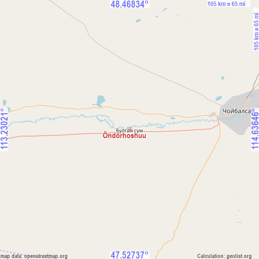
| Upper-left | 48.46834°, | 113.23021° |
| Center: | 48°, | 113.93333° |
| Lower-right: | 47.52737°, | 114.63646° |
| Map W x H: | 104.6×104.6 km | = 65×65mi |
| max Lat: | 51.50725° ⇑42.6% North |
| Öndörhoshuu: | 48° |
| min Lat: | ⇓57.4% South 42.84199° |
| min Long | Öndörhoshuu | max Long |
| 89.14358° | 113.93333° | 118.51014° |
| W 96.9%⇐ | ⇒3.1% E |
Elevation
Elevation of Öndörhoshuu is 788 m = 2585 ft, and this is 628.5 m = 2062 ft below average elevation for this country.
| Max E: |
2800 m = 9186 ft | 92.9% |
| Avg. | 1416.5 m = 4647 ft | |
| Öndörhoshuu | 788 m = 2585 ft | |
Min E: |
619 m = 2031 ft | 7.1% |
See also: Mongolia elevation on elevation.city.
Geographical zone
Öndörhoshuu is located in North temperate zone (between Tropic of Cancer and the Arctic Circle). Distance of this North polar circle is 2064.1 km =1282.6 mi to North.| Distance of | km | miles | from Öndörhoshuu |
|---|---|---|---|
| North Pole | 4670 | 2901.8 | to North |
| Arctic Circle | 2064.1 | 1282.6 | to North |
| Tropic Cancer | 2731.2 | 1697.1 | to South |
| Equator | 5337.1 | 3316.3 | to South |


Nearby cities:
15 places around Öndörhoshuu: (largest is in red/bold)
• Baruun-Urt
154.8 km =96.2 mi,  198°
198°
• Bayan
73.8 km =45.9 mi,  262°
262°
• Choibalsan
45.3 km =28.1 mi,  79°
79°
• Dzüünbulag
154.9 km =96.3 mi,  138°
138°
• Hanhöhiy
141 km =87.6 mi,  252°
252°
• Haylaastay
136.7 km =84.9 mi,  181°
181°
• Hulstay
84.3 km =52.4 mi,  55°
55°
• Javarthushuu
155.4 km =96.6 mi,  325°
325°
• Javhlant
137.6 km =85.5 mi, 259°
• Naranbulag
144.3 km =89.7 mi,  343°
343°
• Sergelen
64 km =39.8 mi,  9°
9°
• Sümiyn Bulag
144.1 km =89.5 mi,  29°
29°
• Tsagaan-Owoo
57.9 km =36 mi,  320°
320°
• Tsagaanders
32.7 km =20.3 mi, 80°
• Uldz
162.5 km =101 mi,  298°
298°
Sources, notices
• [Note1] Compared only with cities in Mongolia existing in our database
• [Src1] Map data: © OpenStreetMap contributors (CC-BY-SA)
• [Src2] Other city data from geonames.org with taken over terms of usage.
• [Src3] Geographical zone / Annual Mean Temperature by Robert A. Rohde @ Wikipedia
