Sergelen geodata
Sergelen (East Aimak) is a seat of a second-order administrative division; located in Mongolia in Asia/Choibalsan (GMT+8) time zone. In our database, there are 33 cities with bigger population. Compared to other cities in Mongolia, 67.8% of cities are located further ↓South; 97.2% of cities are located further ←West and 95.7% of cities have higher elevation than Sergelen. Note1


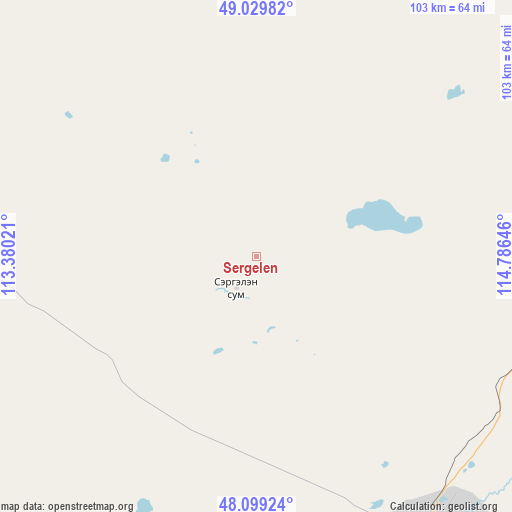
Sergelen GPS coordinates[2]
48° 34' 0.012" North, 114° 4' 59.988" East
| Map corner | latitude | longitude |
|---|---|---|
| Upper-left | 49.02982°, | 113.38021° |
| Center: | 48.56667°, | 114.08333° |
| Lower-right: | 48.09924°, | 114.78646° |
| Map W x H: | 103.5×103.5 km | = 64.3×64.3mi |
| max Lat: | 51.50725° ⇑32.2% North |
| Sergelen: | 48.56667° |
| min Lat: | ⇓67.8% South 42.84199° |
| min Long | Sergelen | max Long |
| 89.14358° | 114.08333° | 118.51014° |
| W 97.2%⇐ | ⇒2.8% E |
Elevation
Elevation of Sergelen is 745 m = 2444 ft, and this is 671.5 m = 2203 ft below average elevation for this country.
| Max E: |
2800 m = 9186 ft | 95.7% |
| Avg. | 1416.5 m = 4647 ft | |
| Sergelen | 745 m = 2444 ft | |
Min E: |
619 m = 2031 ft | 4.3% |
See also: Mongolia elevation on elevation.city.
Geographical zone
Sergelen is located in North temperate zone (between Tropic of Cancer and the Arctic Circle). Distance of this North polar circle is 2001.1 km =1243.4 mi to North.| Distance of | km | miles | from Sergelen |
|---|---|---|---|
| North Pole | 4607 | 2862.7 | to North |
| Arctic Circle | 2001.1 | 1243.4 | to North |
| Tropic Cancer | 2794.2 | 1736.2 | to South |
| Equator | 5400.1 | 3355.5 | to South |


Nearby cities:
15 places around Sergelen: (largest is in red/bold)
• Bayan
110.8 km =68.8 mi,  229°
229°
• Bayan-Ovoo
186.3 km =115.8 mi,  285°
285°
• Choibalsan
64.2 km =39.9 mi,  148°
148°
• Dashbalbar
111.3 km =69.2 mi,  12°
12°
• Ereencav
188.6 km =117.2 mi,  39°
39°
• Hanhöhiy
179.2 km =111.3 mi, 233°
• Hulstay
59.6 km =37 mi,  104°
104°
• Javarthushuu
118.1 km =73.4 mi,  303°
303°
• Javhlant
169.8 km =105.5 mi,  239°
239°
• Naranbulag
91.4 km =56.8 mi,  325°
325°
• Sümiyn Bulag
86 km =53.4 mi, 42°
• Tsagaan-Owoo
51.4 km =31.9 mi,  248°
248°
• Tsagaanders
61.2 km =38 mi,  159°
159°
• Uldz
154.1 km =95.8 mi,  275°
275°
• Öndörhoshuu
64 km =39.8 mi,  189°
189°
Sources, notices
• [Note1] Compared only with cities in Mongolia existing in our database
• [Src1] Map data: © OpenStreetMap contributors (CC-BY-SA)
• [Src2] Other city data from geonames.org with taken over terms of usage.
• [Src3] Geographical zone / Annual Mean Temperature by Robert A. Rohde @ Wikipedia
