Baruun-Urt geodata
Baruun-Urt (Sühbaatar) is a seat of a first-order administrative division; located in Mongolia in Asia/Choibalsan (GMT+8) time zone. With population of 15,805 people, there are 17 cities with bigger population in this country. Compared to other cities in Mongolia, 67.8% of cities are located further ↑North; 94.8% of cities are located further ←West and 86.8% of cities have higher elevation than Baruun-Urt. Note1


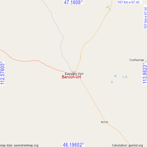
Baruun-Urt GPS coordinates[2]
46° 40' 50.016" North, 113° 16' 45.012" East
| Map corner | latitude | longitude |
|---|---|---|
| Upper-left | 47.1608°, | 112.57605° |
| Center: | 46.68056°, | 113.27917° |
| Lower-right: | 46.19602°, | 113.9823° |
| Map W x H: | 107.3×107.3 km | = 66.7×66.7mi |
| max Lat: | 51.50725° ⇑67.8% North |
| Baruun-Urt: | 46.68056° |
| min Lat: | ⇓32.2% South 42.84199° |
| min Long | Baruun-Urt | max Long |
| 89.14358° | 113.27917° | 118.51014° |
| W 94.8%⇐ | ⇒5.2% E |
Elevation
Elevation of Baruun-Urt is 991 m = 3251 ft, and this is 425.5 m = 1396 ft below average elevation for this country.
| Max E: |
2800 m = 9186 ft | 86.8% |
| Avg. | 1416.5 m = 4647 ft | |
| Baruun-Urt | 991 m = 3251 ft | |
Min E: |
619 m = 2031 ft | 13.2% |
See also: Mongolia elevation on elevation.city.
Geographical zone
Baruun-Urt is located in North temperate zone (between Tropic of Cancer and the Arctic Circle). Distance of this North polar circle is 2210.8 km =1373.7 mi to North.| Distance of | km | miles | from Baruun-Urt |
|---|---|---|---|
| North Pole | 4816.7 | 2993 | to North |
| Arctic Circle | 2210.8 | 1373.7 | to North |
| Tropic Cancer | 2584.5 | 1605.9 | to South |
| Equator | 5190.4 | 3225.2 | to South |


Nearby cities:
15 places around Baruun-Urt: (largest is in red/bold)
• Bayan
139.7 km =86.8 mi,  349°
349°
• Bayasgalant
99.4 km =61.8 mi,  289°
289°
• Dzüünbulag
90.1 km =56 mi,  248°
248°
• Dzüünbulag
156.3 km =97.1 mi,  78°
78°
• Hanhöhiy
135.4 km =84.1 mi,  320°
320°
• Hatavch
62.5 km =38.8 mi,  203°
203°
• Havirga
113.7 km =70.6 mi,  187°
187°
• Haylaastay
47.1 km =29.3 mi, 77°
• Javhlant
150.8 km =93.7 mi, 324°
• Ovoot
159.3 km =99 mi,  163°
163°
• Sergelen
124.1 km =77.1 mi,  244°
244°
• Shireet
127.6 km =79.3 mi,  213°
213°
• Tsagaanders
172.9 km =107.4 mi,  28°
28°
• Ulaandel
41.9 km =26 mi,  147°
147°
• Öndörhoshuu
154.8 km =96.2 mi,  18°
18°
Sources, notices
• [Note1] Compared only with cities in Mongolia existing in our database
• [Src1] Map data: © OpenStreetMap contributors (CC-BY-SA)
• [Src2] Other city data from geonames.org with taken over terms of usage.
• [Src3] Geographical zone / Annual Mean Temperature by Robert A. Rohde @ Wikipedia
