Bayan geodata
Bayan (East Aimak) is a seat of a second-order administrative division; located in Mongolia in Asia/Choibalsan (GMT+8) time zone. In our database, there are 33 cities with bigger population. Compared to other cities in Mongolia, 55.8% of cities are located further ↓South; 93.9% of cities are located further ←West and 91.4% of cities have higher elevation than Bayan. Note1


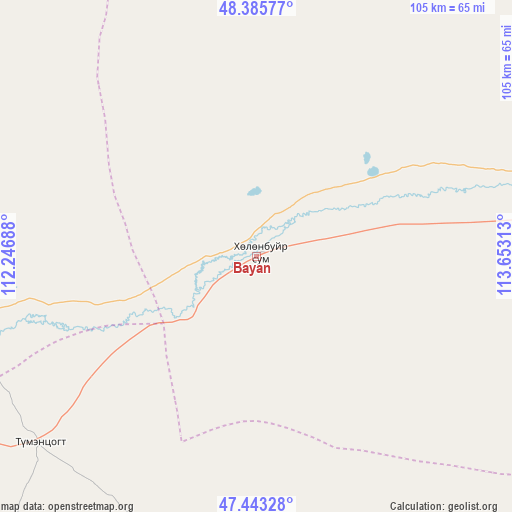
Bayan GPS coordinates[2]
47° 55' 0.012" North, 112° 57' 0" East
| Map corner | latitude | longitude |
|---|---|---|
| Upper-left | 48.38577°, | 112.24688° |
| Center: | 47.91667°, | 112.95° |
| Lower-right: | 47.44328°, | 113.65313° |
| Map W x H: | 104.8×104.8 km | = 65.1×65.1mi |
| max Lat: | 51.50725° ⇑44.2% North |
| Bayan: | 47.91667° |
| min Lat: | ⇓55.8% South 42.84199° |
| min Long | Bayan | max Long |
| 89.14358° | 112.95° | 118.51014° |
| W 93.9%⇐ | ⇒6.1% E |
Elevation
Elevation of Bayan is 864 m = 2835 ft, and this is 552.5 m = 1813 ft below average elevation for this country.
| Max E: |
2800 m = 9186 ft | 91.4% |
| Avg. | 1416.5 m = 4647 ft | |
| Bayan | 864 m = 2835 ft | |
Min E: |
619 m = 2031 ft | 8.6% |
See also: Mongolia elevation on elevation.city.
Geographical zone
Bayan is located in North temperate zone (between Tropic of Cancer and the Arctic Circle). Distance of this North polar circle is 2073.3 km =1288.3 mi to North.| Distance of | km | miles | from Bayan |
|---|---|---|---|
| North Pole | 4679.2 | 2907.5 | to North |
| Arctic Circle | 2073.3 | 1288.3 | to North |
| Tropic Cancer | 2721.9 | 1691.3 | to South |
| Equator | 5327.8 | 3310.5 | to South |


Nearby cities:
15 places around Bayan: (largest is in red/bold)
• Baruun-Urt
139.7 km =86.8 mi,  169°
169°
• Bayasgalant
123.9 km =77 mi,  213°
213°
• Choibalsan
119 km =73.9 mi,  81°
81°
• Dundbürd
108.2 km =67.2 mi,  271°
271°
• Hanhöhiy
69.6 km =43.2 mi,  241°
241°
• Haylaastay
145.5 km =90.4 mi,  151°
151°
• Hulstay
153.3 km =95.3 mi,  67°
67°
• Javarthushuu
138.1 km =85.8 mi,  353°
353°
• Javhlant
63.9 km =39.7 mi,  256°
256°
• Naranbulag
150.8 km =93.7 mi,  11°
11°
• Sergelen
110.8 km =68.8 mi,  49°
49°
• Tsagaan-Owoo
64.6 km =40.1 mi,  33°
33°
• Tsagaanders
106.5 km =66.2 mi, 81°
• Uldz
111.3 km =69.2 mi,  320°
320°
• Öndörhoshuu
73.8 km =45.9 mi, 82°
Sources, notices
• [Note1] Compared only with cities in Mongolia existing in our database
• [Src1] Map data: © OpenStreetMap contributors (CC-BY-SA)
• [Src2] Other city data from geonames.org with taken over terms of usage.
• [Src3] Geographical zone / Annual Mean Temperature by Robert A. Rohde @ Wikipedia
