Javhlant geodata
Javhlant (Hentiy) is a seat of a second-order administrative division; located in Mongolia in Asia/Ulaanbaatar (GMT+8) time zone. In our database, there are 33 cities with bigger population. Compared to other cities in Mongolia, 52.8% of cities are located further ↓South; 92.3% of cities are located further ←West and 89% of cities have higher elevation than Javhlant. Note1


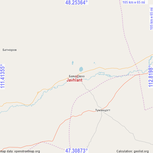
Javhlant GPS coordinates[2]
47° 46' 59.988" North, 112° 7' 0.012" East
| Map corner | latitude | longitude |
|---|---|---|
| Upper-left | 48.25364°, | 111.41355° |
| Center: | 47.78333°, | 112.11667° |
| Lower-right: | 47.30873°, | 112.8198° |
| Map W x H: | 105.1×105.1 km | = 65.3×65.3mi |
| max Lat: | 51.50725° ⇑47.2% North |
| Javhlant: | 47.78333° |
| min Lat: | ⇓52.8% South 42.84199° |
| min Long | Javhlant | max Long |
| 89.14358° | 112.11667° | 118.51014° |
| W 92.3%⇐ | ⇒7.7% E |
Elevation
Elevation of Javhlant is 919 m = 3015 ft, and this is 497.5 m = 1632 ft below average elevation for this country.
| Max E: |
2800 m = 9186 ft | 89% |
| Avg. | 1416.5 m = 4647 ft | |
| Javhlant | 919 m = 3015 ft | |
Min E: |
619 m = 2031 ft | 11% |
See also: Mongolia elevation on elevation.city.
Geographical zone
Javhlant is located in North temperate zone (between Tropic of Cancer and the Arctic Circle). Distance of this North polar circle is 2088.2 km =1297.5 mi to North.| Distance of | km | miles | from Javhlant |
|---|---|---|---|
| North Pole | 4694.1 | 2916.8 | to North |
| Arctic Circle | 2088.2 | 1297.5 | to North |
| Tropic Cancer | 2707.1 | 1682.1 | to South |
| Equator | 5313 | 3301.3 | to South |


Nearby cities:
15 places around Javhlant: (largest is in red/bold)
• Baruun-Urt
150.8 km =93.7 mi,  144°
144°
• Bayan
63.9 km =39.7 mi,  76°
76°
• Bayan
114.6 km =71.2 mi,  318°
318°
• Bayan
119.4 km =74.2 mi,  234°
234°
• Bayan-Ovoo
141.7 km =88 mi,  345°
345°
• Bayasgalant
89.1 km =55.4 mi,  183°
183°
• Dundbürd
49.6 km =30.8 mi,  291°
291°
• Hanhöhiy
18.6 km =11.6 mi, 176°
• Herlen
128.2 km =79.7 mi,  245°
245°
• Mörön
142.2 km =88.4 mi, 251°
• Onon
145.7 km =90.5 mi,  309°
309°
• Tsagaan-Owoo
119.4 km =74.2 mi,  54°
54°
• Uldz
101.2 km =62.9 mi, 354°
• Undurkhaan
121.2 km =75.3 mi,  244°
244°
• Öndörhoshuu
137.6 km =85.5 mi, 79°
Sources, notices
• [Note1] Compared only with cities in Mongolia existing in our database
• [Src1] Map data: © OpenStreetMap contributors (CC-BY-SA)
• [Src2] Other city data from geonames.org with taken over terms of usage.
• [Src3] Geographical zone / Annual Mean Temperature by Robert A. Rohde @ Wikipedia
