Uldz geodata
Uldz (Hentiy) is a seat of a second-order administrative division; located in Mongolia in Asia/Ulaanbaatar (GMT+8) time zone. In our database, there are 33 cities with bigger population. Compared to other cities in Mongolia, 71.2% of cities are located further ↓South; 91.7% of cities are located further ←West and 81.6% of cities have higher elevation than Uldz. Note1


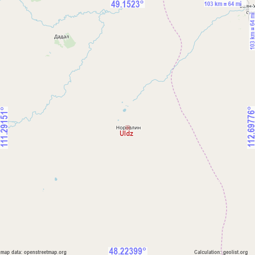
Uldz GPS coordinates[2]
48° 41' 25.008" North, 111° 59' 40.668" East
| Map corner | latitude | longitude |
|---|---|---|
| Upper-left | 49.1523°, | 111.29151° |
| Center: | 48.69028°, | 111.99463° |
| Lower-right: | 48.22399°, | 112.69776° |
| Map W x H: | 103.2×103.2 km | = 64.1×64.1mi |
| max Lat: | 51.50725° ⇑28.8% North |
| Uldz: | 48.69028° |
| min Lat: | ⇓71.2% South 42.84199° |
| min Long | Uldz | max Long |
| 89.14358° | 111.99463° | 118.51014° |
| W 91.7%⇐ | ⇒8.3% E |
Elevation
Elevation of Uldz is 1036 m = 3399 ft, and this is 380.5 m = 1248 ft below average elevation for this country.
| Max E: |
2800 m = 9186 ft | 81.6% |
| Avg. | 1416.5 m = 4647 ft | |
| Uldz | 1036 m = 3399 ft | |
Min E: |
619 m = 2031 ft | 18.4% |
See also: Mongolia elevation on elevation.city.
Geographical zone
Uldz is located in North temperate zone (between Tropic of Cancer and the Arctic Circle). Distance of this North polar circle is 1987.3 km =1234.9 mi to North.| Distance of | km | miles | from Uldz |
|---|---|---|---|
| North Pole | 4593.2 | 2854.1 | to North |
| Arctic Circle | 1987.3 | 1234.9 | to North |
| Tropic Cancer | 2807.9 | 1744.7 | to South |
| Equator | 5413.9 | 3364 | to South |


Nearby cities:
15 places around Uldz: (largest is in red/bold)
• Bayan
68.8 km =42.8 mi,  256°
256°
• Bayan
111.3 km =69.2 mi,  140°
140°
• Bayan-Ovoo
44.9 km =27.9 mi,  323°
323°
• Bayanbulag
179 km =111.2 mi,  239°
239°
• Dundbürd
90.6 km =56.3 mi,  203°
203°
• Eg
133 km =82.6 mi,  269°
269°
• Hanhöhiy
119.8 km =74.4 mi,  175°
175°
• Javarthushuu
74.3 km =46.2 mi,  46°
46°
• Javhlant
101.2 km =62.9 mi,  174°
174°
• Naranbulag
118 km =73.3 mi,  58°
58°
• Onon
102.8 km =63.9 mi, 265°
• Sergelen
154.1 km =95.8 mi,  95°
95°
• Tsagaan-Owoo
110.7 km =68.8 mi,  106°
106°
• Undurkhaan
182.1 km =113.2 mi,  213°
213°
• Öndörhoshuu
162.5 km =101 mi,  118°
118°
Sources, notices
• [Note1] Compared only with cities in Mongolia existing in our database
• [Src1] Map data: © OpenStreetMap contributors (CC-BY-SA)
• [Src2] Other city data from geonames.org with taken over terms of usage.
• [Src3] Geographical zone / Annual Mean Temperature by Robert A. Rohde @ Wikipedia
