Choibalsan geodata
Choibalsan (East Aimak) is a seat of a first-order administrative division; located in Mongolia in Asia/Choibalsan (GMT+8) time zone. With population of 23 people, there are 31 cities with bigger population in this country. Compared to other cities in Mongolia, 59.5% of cities are located further ↓South; 98.2% of cities are located further ←West and 96.3% of cities have higher elevation than Choibalsan. Note1


Choibalsan GPS coordinates[2]
48° 4' 21.252" North, 114° 31' 57.504" East
| Map corner | latitude | longitude |
|---|---|---|
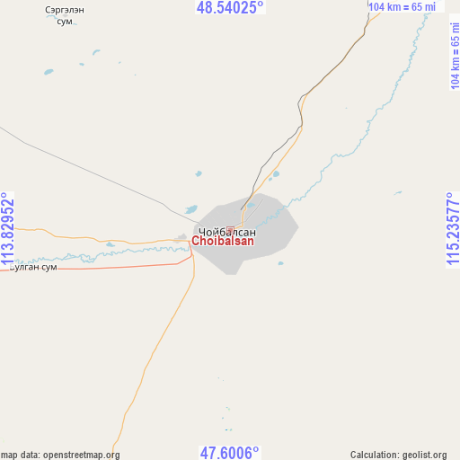
| Upper-left | 48.54025°, | 113.82952° |
| Center: | 48.07257°, | 114.53264° |
| Lower-right: | 47.6006°, | 115.23577° |
| Map W x H: | 104.5×104.5 km | = 64.9×64.9mi |
| max Lat: | 51.50725° ⇑40.5% North |
| Choibalsan: | 48.07257° |
| min Lat: | ⇓59.5% South 42.84199° |
| min Long | Choibalsan | max Long |
| 89.14358° | 114.53264° | 118.51014° |
| W 98.2%⇐ | ⇒1.8% E |
Elevation
Elevation of Choibalsan is 741 m = 2431 ft, and this is 675.5 m = 2216 ft below average elevation for this country.
| Max E: |
2800 m = 9186 ft | 96.3% |
| Avg. | 1416.5 m = 4647 ft | |
| Choibalsan | 741 m = 2431 ft | |
Min E: |
619 m = 2031 ft | 3.7% |
See also: Mongolia elevation on elevation.city.
Geographical zone
Choibalsan is located in North temperate zone (between Tropic of Cancer and the Arctic Circle). Distance of this North polar circle is 2056 km =1277.5 mi to North.| Distance of | km | miles | from Choibalsan |
|---|---|---|---|
| North Pole | 4661.9 | 2896.8 | to North |
| Arctic Circle | 2056 | 1277.5 | to North |
| Tropic Cancer | 2739.2 | 1702.1 | to South |
| Equator | 5345.2 | 3321.4 | to South |


Nearby cities:
15 places around Choibalsan: (largest is in red/bold)
• Baruun-Urt
181.3 km =112.7 mi,  211°
211°
• Bayan
119 km =73.9 mi,  261°
261°
• Dashbalbar
164.1 km =102 mi,  356°
356°
• Dzüünbulag
136.9 km =85.1 mi,  155°
155°
• Hanhöhiy
186.1 km =115.6 mi,  254°
254°
• Haylaastay
152.8 km =94.9 mi,  198°
198°
• Hulstay
47.1 km =29.3 mi,  31°
31°
• Javarthushuu
178.5 km =110.9 mi,  312°
312°
• Javhlant
182.8 km =113.6 mi, 259°
• Naranbulag
155.5 km =96.6 mi,  326°
326°
• Sergelen
64.2 km =39.9 mi, 328°
• Sümiyn Bulag
120.7 km =75 mi,  12°
12°
• Tsagaan-Owoo
89.2 km =55.4 mi,  294°
294°
• Tsagaanders
12.6 km =7.8 mi, 258°
• Öndörhoshuu
45.3 km =28.1 mi, 259°
Sources, notices
• [Note1] Compared only with cities in Mongolia existing in our database
• [Src1] Map data: © OpenStreetMap contributors (CC-BY-SA)
• [Src2] Other city data from geonames.org with taken over terms of usage.
• [Src3] Geographical zone / Annual Mean Temperature by Robert A. Rohde @ Wikipedia
