Hulstay geodata
Hulstay (East Aimak) is a seat of a second-order administrative division; located in Mongolia in Asia/Choibalsan (GMT+8) time zone. In our database, there are 33 cities with bigger population. Compared to other cities in Mongolia, 65.3% of cities are located further ↓South; 98.5% of cities are located further ←West and 98.2% of cities have higher elevation than Hulstay. Note1


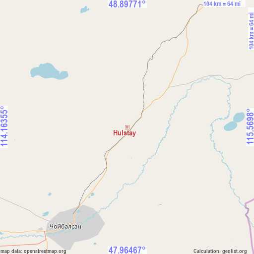
Hulstay GPS coordinates[2]
48° 25' 59.988" North, 114° 52' 0.012" East
| Map corner | latitude | longitude |
|---|---|---|
| Upper-left | 48.89771°, | 114.16355° |
| Center: | 48.43333°, | 114.86667° |
| Lower-right: | 47.96467°, | 115.5698° |
| Map W x H: | 103.7×103.7 km | = 64.4×64.4mi |
| max Lat: | 51.50725° ⇑34.7% North |
| Hulstay: | 48.43333° |
| min Lat: | ⇓65.3% South 42.84199° |
| min Long | Hulstay | max Long |
| 89.14358° | 114.86667° | 118.51014° |
| W 98.5%⇐ | ⇒1.5% E |
Elevation
Elevation of Hulstay is 685 m = 2247 ft, and this is 731.5 m = 2400 ft below average elevation for this country.
| Max E: |
2800 m = 9186 ft | 98.2% |
| Avg. | 1416.5 m = 4647 ft | |
| Hulstay | 685 m = 2247 ft | |
Min E: |
619 m = 2031 ft | 1.8% |
See also: Mongolia elevation on elevation.city.
Geographical zone
Hulstay is located in North temperate zone (between Tropic of Cancer and the Arctic Circle). Distance of this North polar circle is 2015.9 km =1252.6 mi to North.| Distance of | km | miles | from Hulstay |
|---|---|---|---|
| North Pole | 4621.8 | 2871.9 | to North |
| Arctic Circle | 2015.9 | 1252.6 | to North |
| Tropic Cancer | 2779.4 | 1727 | to South |
| Equator | 5385.3 | 3346.3 | to South |


Nearby cities:
15 places around Hulstay: (largest is in red/bold)
• Bayan
153.3 km =95.3 mi,  247°
247°
• Choibalsan
47.1 km =29.3 mi,  211°
211°
• Dashbalbar
128.2 km =79.7 mi,  344°
344°
• Dzüünbulag
167.6 km =104.1 mi,  169°
169°
• Ereencav
172.6 km =107.2 mi,  21°
21°
• Haylaastay
199 km =123.7 mi,  201°
201°
• Javarthushuu
175.4 km =109 mi,  297°
297°
• Javhlant
216.6 km =134.6 mi, 250°
• Naranbulag
141.6 km =88 mi,  309°
309°
• Sergelen
59.6 km =37 mi,  284°
284°
• Sümiyn Bulag
77.8 km =48.3 mi,  0°
0°
• Tsagaan-Owoo
105.8 km =65.7 mi,  267°
267°
• Tsagaanders
56.5 km =35.1 mi,  220°
220°
• Uldz
213.3 km =132.5 mi, 277°
• Öndörhoshuu
84.3 km =52.4 mi,  235°
235°
Sources, notices
• [Note1] Compared only with cities in Mongolia existing in our database
• [Src1] Map data: © OpenStreetMap contributors (CC-BY-SA)
• [Src2] Other city data from geonames.org with taken over terms of usage.
• [Src3] Geographical zone / Annual Mean Temperature by Robert A. Rohde @ Wikipedia
