Dzaanhoshuu geodata
Dzaanhoshuu (Arhangay) is a seat of a second-order administrative division; located in Mongolia in Asia/Ulaanbaatar (GMT+8) time zone. In our database, there are 33 cities with bigger population. Compared to other cities in Mongolia, 52.8% of cities are located further ↑North; 60.1% of cities are located further →East and 78.5% of cities have lower elevation than Dzaanhoshuu. Note1


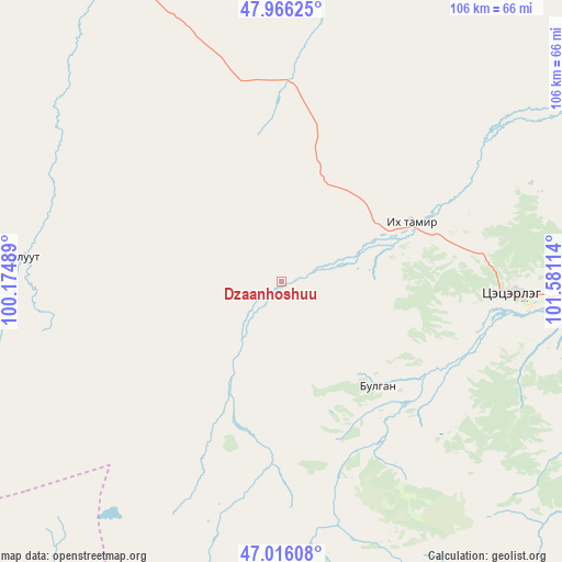
Dzaanhoshuu GPS coordinates[2]
47° 29' 35.916" North, 100° 52' 40.836" East
| Map corner | latitude | longitude |
|---|---|---|
| Upper-left | 47.96625°, | 100.17489° |
| Center: | 47.49331°, | 100.87801° |
| Lower-right: | 47.01608°, | 101.58114° |
| Map W x H: | 105.6×105.6 km | = 65.6×65.6mi |
| max Lat: | 51.50725° ⇑52.8% North |
| Dzaanhoshuu: | 47.49331° |
| min Lat: | ⇓47.2% South 42.84199° |
| min Long | Dzaanhoshuu | max Long |
| 89.14358° | 100.87801° | 118.51014° |
| W 39.9%⇐ | ⇒60.1% E |
Elevation
Elevation of Dzaanhoshuu is 1765 m = 5791 ft, and this is 348.5 m = 1143 ft above average elevation for this country.
| Max E: |
2800 m = 9186 ft | 21.5% |
| Dzaanhoshuu | 1765 m 5791 ft | |
| Avg. | 1416.5 m = 4647 ft | |
Min E: |
619 m = 2031 ft | 78.5% |
See also: Mongolia elevation on elevation.city.
Geographical zone
Dzaanhoshuu is located in North temperate zone (between Tropic of Cancer and the Arctic Circle). Distance of this North polar circle is 2120.4 km =1317.6 mi to North.| Distance of | km | miles | from Dzaanhoshuu |
|---|---|---|---|
| North Pole | 4726.3 | 2936.8 | to North |
| Arctic Circle | 2120.4 | 1317.6 | to North |
| Tropic Cancer | 2674.8 | 1662 | to South |
| Equator | 5280.8 | 3281.3 | to South |


Nearby cities:
15 places around Dzaanhoshuu: (largest is in red/bold)
• Altan-Ovoo
66.1 km =41.1 mi,  94°
94°
• Bayanhongor
103.8 km =64.5 mi,  213°
213°
• Bayanhoshuu
104.1 km =64.7 mi, 212°
• Bulagiyn Denj
26.4 km =16.4 mi,  137°
137°
• Erdenetsogt
119.6 km =74.3 mi,  182°
182°
• Horgo
105.3 km =65.4 mi,  314°
314°
• Hotont
120.5 km =74.9 mi,  96°
96°
• Hunt
113.5 km =70.5 mi,  291°
291°
• Jargalant
49.9 km =31 mi,  275°
275°
• Jargalant
88.5 km =55 mi,  67°
67°
• Jargalant
101.3 km =62.9 mi,  247°
247°
• Tavanbulag
78.5 km =48.8 mi, 99°
• Teel
67.4 km =41.9 mi,  335°
335°
• Tsetserleg
43.3 km =26.9 mi, 92°
• Öldziyt
120.9 km =75.1 mi,  17°
17°
Sources, notices
• [Note1] Compared only with cities in Mongolia existing in our database
• [Src1] Map data: © OpenStreetMap contributors (CC-BY-SA)
• [Src2] Other city data from geonames.org with taken over terms of usage.
• [Src3] Geographical zone / Annual Mean Temperature by Robert A. Rohde @ Wikipedia
