Bulagiyn Denj geodata
Bulagiyn Denj (Arhangay) is a seat of a second-order administrative division; located in Mongolia in Asia/Ulaanbaatar (GMT+8) time zone. In our database, there are 33 cities with bigger population. Compared to other cities in Mongolia, 56.4% of cities are located further ↑North; 58.9% of cities are located further →East and 85.6% of cities have lower elevation than Bulagiyn Denj. Note1


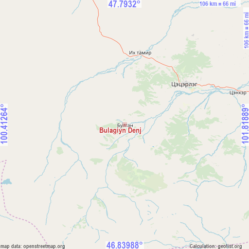
Bulagiyn Denj GPS coordinates[2]
47° 19' 7.284" North, 101° 6' 56.736" East
| Map corner | latitude | longitude |
|---|---|---|
| Upper-left | 47.7932°, | 100.41264° |
| Center: | 47.31869°, | 101.11576° |
| Lower-right: | 46.83988°, | 101.81889° |
| Map W x H: | 106×106 km | = 65.9×65.9mi |
| max Lat: | 51.50725° ⇑56.4% North |
| Bulagiyn Denj: | 47.31869° |
| min Lat: | ⇓43.6% South 42.84199° |
| min Long | Bulagiyn Denj | max Long |
| 89.14358° | 101.11576° | 118.51014° |
| W 41.1%⇐ | ⇒58.9% E |
Elevation
Elevation of Bulagiyn Denj is 1909 m = 6263 ft, and this is 492.5 m = 1616 ft above average elevation for this country.
| Max E: |
2800 m = 9186 ft | 14.4% |
| Bulagiyn Denj | 1909 m 6263 ft | |
| Avg. | 1416.5 m = 4647 ft | |
Min E: |
619 m = 2031 ft | 85.6% |
See also: Mongolia elevation on elevation.city.
Geographical zone
Bulagiyn Denj is located in North temperate zone (between Tropic of Cancer and the Arctic Circle). Distance of this North polar circle is 2139.8 km =1329.6 mi to North.| Distance of | km | miles | from Bulagiyn Denj |
|---|---|---|---|
| North Pole | 4745.7 | 2948.8 | to North |
| Arctic Circle | 2139.8 | 1329.6 | to North |
| Tropic Cancer | 2655.4 | 1650 | to South |
| Equator | 5261.3 | 3269.2 | to South |


Nearby cities:
15 places around Bulagiyn Denj: (largest is in red/bold)
• Altan-Ovoo
50.2 km =31.2 mi,  73°
73°
• Bayanhongor
101.1 km =62.8 mi,  228°
228°
• Bayanhoshuu
100.7 km =62.6 mi, 227°
• Dzaanhoshuu
26.4 km =16.4 mi,  317°
317°
• Dzegstey
114.5 km =71.1 mi, 70°
• Erdenetsogt
102.6 km =63.8 mi,  192°
192°
• Hotont
102 km =63.4 mi,  87°
87°
• Höhbürd
125.6 km =78 mi,  203°
203°
• Jargalant
71.7 km =44.6 mi,  289°
289°
• Jargalant
83.1 km =51.6 mi,  50°
50°
• Jargalant
113.5 km =70.5 mi,  260°
260°
• Tavanbulag
60.1 km =37.3 mi,  83°
83°
• Teel
92.8 km =57.7 mi,  330°
330°
• Tsetserleg
30.8 km =19.1 mi,  55°
55°
• Övt
102.4 km =63.6 mi,  123°
123°
Sources, notices
• [Note1] Compared only with cities in Mongolia existing in our database
• [Src1] Map data: © OpenStreetMap contributors (CC-BY-SA)
• [Src2] Other city data from geonames.org with taken over terms of usage.
• [Src3] Geographical zone / Annual Mean Temperature by Robert A. Rohde @ Wikipedia
