Jargalant geodata
Jargalant (Arhangay) is a seat of a second-order administrative division; located in Mongolia in Asia/Ulaanbaatar (GMT+8) time zone. In our database, there are 33 cities with bigger population. Compared to other cities in Mongolia, 51.8% of cities are located further ↑North; 64.4% of cities are located further →East and 90.8% of cities have lower elevation than Jargalant. Note1


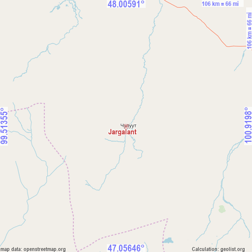
Jargalant GPS coordinates[2]
47° 31' 59.988" North, 100° 13' 0.012" East
| Map corner | latitude | longitude |
|---|---|---|
| Upper-left | 48.00591°, | 99.51355° |
| Center: | 47.53333°, | 100.21667° |
| Lower-right: | 47.05646°, | 100.9198° |
| Map W x H: | 105.6×105.6 km | = 65.6×65.6mi |
| max Lat: | 51.50725° ⇑51.8% North |
| Jargalant: | 47.53333° |
| min Lat: | ⇓48.2% South 42.84199° |
| min Long | Jargalant | max Long |
| 89.14358° | 100.21667° | 118.51014° |
| W 35.6%⇐ | ⇒64.4% E |
Elevation
Elevation of Jargalant is 2033 m = 6670 ft, and this is 616.5 m = 2023 ft above average elevation for this country.
| Max E: |
2800 m = 9186 ft | 9.2% |
| Jargalant | 2033 m 6670 ft | |
| Avg. | 1416.5 m = 4647 ft | |
Min E: |
619 m = 2031 ft | 90.8% |
See also: Mongolia elevation on elevation.city.
Geographical zone
Jargalant is located in North temperate zone (between Tropic of Cancer and the Arctic Circle). Distance of this North polar circle is 2116 km =1314.8 mi to North.| Distance of | km | miles | from Jargalant |
|---|---|---|---|
| North Pole | 4721.9 | 2934.1 | to North |
| Arctic Circle | 2116 | 1314.8 | to North |
| Tropic Cancer | 2679.3 | 1664.8 | to South |
| Equator | 5285.2 | 3284.1 | to South |


Nearby cities:
15 places around Jargalant: (largest is in red/bold)
• Altan-Ovoo
116 km =72.1 mi,  94°
94°
• Bayanhongor
91.1 km =56.6 mi,  184°
184°
• Bayanhoshuu
92.6 km =57.5 mi, 183°
• Bulagiyn Denj
71.7 km =44.6 mi,  109°
109°
• Dzaanhoshuu
49.9 km =31 mi,  95°
95°
• Dzag
103 km =64 mi,  230°
230°
• Erdenetsogt
132.2 km =82.1 mi,  159°
159°
• Horgo
74.2 km =46.1 mi,  339°
339°
• Hunt
67.3 km =41.8 mi,  303°
303°
• Höviyn Am
128.3 km =79.7 mi,  254°
254°
• Jargalant
61.2 km =38 mi, 225°
• Tavanbulag
128.3 km =79.7 mi, 97°
• Teel
61.1 km =38 mi,  20°
20°
• Tsahir
118.7 km =73.8 mi, 300°
• Tsetserleg
93.2 km =57.9 mi, 93°
Sources, notices
• [Note1] Compared only with cities in Mongolia existing in our database
• [Src1] Map data: © OpenStreetMap contributors (CC-BY-SA)
• [Src2] Other city data from geonames.org with taken over terms of usage.
• [Src3] Geographical zone / Annual Mean Temperature by Robert A. Rohde @ Wikipedia
