Jargalant geodata
Jargalant (Arhangay) is a seat of a second-order administrative division; located in Mongolia in Asia/Ulaanbaatar (GMT+8) time zone. In our database, there are 33 cities with bigger population. Compared to other cities in Mongolia, 53.1% of cities are located further ↓South; 54.9% of cities are located further →East and 54% of cities have lower elevation than Jargalant. Note1


Jargalant GPS coordinates[2]
47° 47' 35.124" North, 101° 58' 20.46" East
| Map corner | latitude | longitude |
|---|---|---|
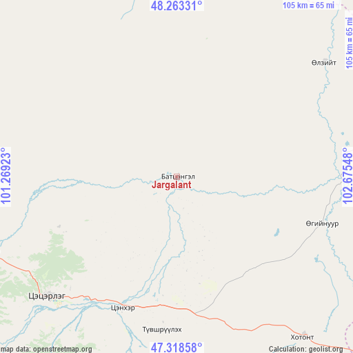
| Upper-left | 48.26331°, | 101.26923° |
| Center: | 47.79309°, | 101.97235° |
| Lower-right: | 47.31858°, | 102.67548° |
| Map W x H: | 105×105 km | = 65.2×65.2mi |
| max Lat: | 51.50725° ⇑46.9% North |
| Jargalant: | 47.79309° |
| min Lat: | ⇓53.1% South 42.84199° |
| min Long | Jargalant | max Long |
| 89.14358° | 101.97235° | 118.51014° |
| W 45.1%⇐ | ⇒54.9% E |
Elevation
Elevation of Jargalant is 1428 m = 4685 ft, and this is 11.5 m = 38 ft above average elevation for this country.
| Max E: |
2800 m = 9186 ft | 46% |
| Jargalant | 1428 m 4685 ft | |
| Avg. | 1416.5 m = 4647 ft | |
Min E: |
619 m = 2031 ft | 54% |
See also: Mongolia elevation on elevation.city.
Geographical zone
Jargalant is located in North temperate zone (between Tropic of Cancer and the Arctic Circle). Distance of this North polar circle is 2087.1 km =1296.9 mi to North.| Distance of | km | miles | from Jargalant |
|---|---|---|---|
| North Pole | 4693 | 2916.1 | to North |
| Arctic Circle | 2087.1 | 1296.9 | to North |
| Tropic Cancer | 2708.2 | 1682.8 | to South |
| Equator | 5314.1 | 3302 | to South |


Nearby cities:
15 places around Jargalant: (largest is in red/bold)
• Altan-Ovoo
41.7 km =25.9 mi,  202°
202°
• Bayan
96.1 km =59.7 mi,  113°
113°
• Bulagiyn Denj
83.1 km =51.6 mi,  230°
230°
• Dzaanhoshuu
88.5 km =55 mi,  247°
247°
• Dzegstey
45.4 km =28.2 mi, 107°
• Erhet
92.1 km =57.2 mi,  54°
54°
• Harhorin
92.1 km =57.2 mi,  135°
135°
• Hotont
60.6 km =37.7 mi, 142°
• Höshööt
55.4 km =34.4 mi, 51°
• Hüremt
108.1 km =67.2 mi,  26°
26°
• Kharkhorin
91.9 km =57.1 mi, 136°
• Tavanbulag
46 km =28.6 mi,  186°
186°
• Tsetserleg
52.5 km =32.6 mi, 227°
• Uubulan
90.7 km =56.4 mi,  358°
358°
• Öldziyt
93 km =57.8 mi,  331°
331°
Sources, notices
• [Note1] Compared only with cities in Mongolia existing in our database
• [Src1] Map data: © OpenStreetMap contributors (CC-BY-SA)
• [Src2] Other city data from geonames.org with taken over terms of usage.
• [Src3] Geographical zone / Annual Mean Temperature by Robert A. Rohde @ Wikipedia
