Höshööt geodata
Höshööt (Arhangay) is a seat of a second-order administrative division; located in Mongolia in Asia/Ulaanbaatar (GMT+8) time zone. In our database, there are 33 cities with bigger population. Compared to other cities in Mongolia, 60.1% of cities are located further ↓South; 50.6% of cities are located further →East and 56.4% of cities have higher elevation than Höshööt. Note1


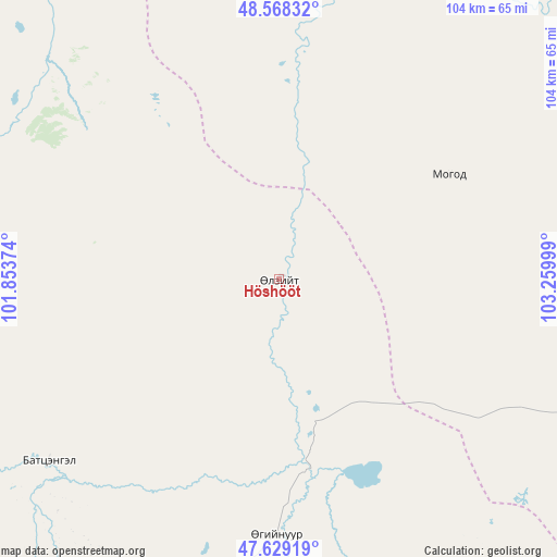
Höshööt GPS coordinates[2]
48° 6' 3.24" North, 102° 33' 24.696" East
| Map corner | latitude | longitude |
|---|---|---|
| Upper-left | 48.56832°, | 101.85374° |
| Center: | 48.1009°, | 102.55686° |
| Lower-right: | 47.62919°, | 103.25999° |
| Map W x H: | 104.4×104.4 km | = 64.9×64.9mi |
| max Lat: | 51.50725° ⇑39.9% North |
| Höshööt: | 48.1009° |
| min Lat: | ⇓60.1% South 42.84199° |
| min Long | Höshööt | max Long |
| 89.14358° | 102.55686° | 118.51014° |
| W 49.4%⇐ | ⇒50.6% E |
Elevation
Elevation of Höshööt is 1300 m = 4265 ft, and this is 116.5 m = 382 ft below average elevation for this country.
| Max E: |
2800 m = 9186 ft | 56.4% |
| Avg. | 1416.5 m = 4647 ft | |
| Höshööt | 1300 m = 4265 ft | |
Min E: |
619 m = 2031 ft | 43.6% |
See also: Mongolia elevation on elevation.city.
Geographical zone
Höshööt is located in North temperate zone (between Tropic of Cancer and the Arctic Circle). Distance of this North polar circle is 2052.9 km =1275.6 mi to North.| Distance of | km | miles | from Höshööt |
|---|---|---|---|
| North Pole | 4658.7 | 2894.8 | to North |
| Arctic Circle | 2052.9 | 1275.6 | to North |
| Tropic Cancer | 2742.4 | 1704 | to South |
| Equator | 5348.3 | 3323.3 | to South |


Nearby cities:
15 places around Höshööt: (largest is in red/bold)
• Altan-Ovoo
94.2 km =58.5 mi,  219°
219°
• Avdzaga
88.5 km =55 mi,  125°
125°
• Bayan
84.9 km =52.8 mi,  148°
148°
• Darhan
99.6 km =61.9 mi,  80°
80°
• Dzegstey
48.1 km =29.9 mi,  180°
180°
• Erhet
36.9 km =22.9 mi,  58°
58°
• Harhorin
102.4 km =63.6 mi,  168°
168°
• Hotont
82.3 km =51.1 mi, 184°
• Hüremt
62.7 km =39 mi,  4°
4°
• Jargalant
55.4 km =34.4 mi,  231°
231°
• Maanĭt
68 km =42.3 mi,  71°
71°
• Mandal
92.9 km =57.7 mi,  50°
50°
• Tavanbulag
93.5 km =58.1 mi,  211°
211°
• Uubulan
72.8 km =45.2 mi,  320°
320°
• Öldziyt
99.6 km =61.9 mi,  298°
298°
Sources, notices
• [Note1] Compared only with cities in Mongolia existing in our database
• [Src1] Map data: © OpenStreetMap contributors (CC-BY-SA)
• [Src2] Other city data from geonames.org with taken over terms of usage.
• [Src3] Geographical zone / Annual Mean Temperature by Robert A. Rohde @ Wikipedia
