Erhet geodata
Erhet (Bulgan) is a seat of a second-order administrative division; located in Mongolia in Asia/Ulaanbaatar (GMT+8) time zone. In our database, there are 33 cities with bigger population. Compared to other cities in Mongolia, 63.2% of cities are located further ↓South; 52.1% of cities are located further ←West and 56.7% of cities have lower elevation than Erhet. Note1


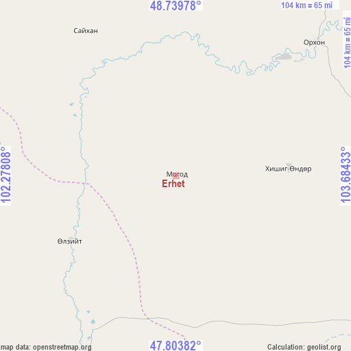
Erhet GPS coordinates[2]
48° 16' 26.184" North, 102° 58' 52.32" East
| Map corner | latitude | longitude |
|---|---|---|
| Upper-left | 48.73978°, | 102.27808° |
| Center: | 48.27394°, | 102.9812° |
| Lower-right: | 47.80382°, | 103.68433° |
| Map W x H: | 104.1×104.1 km | = 64.7×64.7mi |
| max Lat: | 51.50725° ⇑36.8% North |
| Erhet: | 48.27394° |
| min Lat: | ⇓63.2% South 42.84199° |
| min Long | Erhet | max Long |
| 89.14358° | 102.9812° | 118.51014° |
| W 52.1%⇐ | ⇒47.9% E |
Elevation
Elevation of Erhet is 1450 m = 4757 ft, and this is 33.5 m = 110 ft above average elevation for this country.
| Max E: |
2800 m = 9186 ft | 43.3% |
| Erhet | 1450 m 4757 ft | |
| Avg. | 1416.5 m = 4647 ft | |
Min E: |
619 m = 2031 ft | 56.7% |
See also: Mongolia elevation on elevation.city.
Geographical zone
Erhet is located in North temperate zone (between Tropic of Cancer and the Arctic Circle). Distance of this North polar circle is 2033.6 km =1263.6 mi to North.| Distance of | km | miles | from Erhet |
|---|---|---|---|
| North Pole | 4639.5 | 2882.9 | to North |
| Arctic Circle | 2033.6 | 1263.6 | to North |
| Tropic Cancer | 2761.6 | 1716 | to South |
| Equator | 5367.6 | 3335.3 | to South |


Nearby cities:
15 places around Erhet: (largest is in red/bold)
• Avdzaga
81.6 km =50.7 mi,  150°
150°
• Bayan
92.5 km =57.5 mi,  172°
172°
• Bugat
101.5 km =63.1 mi,  29°
29°
• Bulgan
72.4 km =45 mi, 34°
• Darhan
66.6 km =41.4 mi,  91°
91°
• Dashinchilling
92.4 km =57.4 mi,  120°
120°
• Dzegstey
74.6 km =46.4 mi,  205°
205°
• Hotont
108.3 km =67.3 mi,  200°
200°
• Höshööt
36.9 km =22.9 mi,  238°
238°
• Hüremt
50.7 km =31.5 mi,  328°
328°
• Jargalant
92.1 km =57.2 mi,  234°
234°
• Maanĭt
33 km =20.5 mi, 85°
• Mandal
56.7 km =35.2 mi,  45°
45°
• Sharga
107.6 km =66.9 mi,  322°
322°
• Uubulan
85.7 km =53.3 mi,  295°
295°
Sources, notices
• [Note1] Compared only with cities in Mongolia existing in our database
• [Src1] Map data: © OpenStreetMap contributors (CC-BY-SA)
• [Src2] Other city data from geonames.org with taken over terms of usage.
• [Src3] Geographical zone / Annual Mean Temperature by Robert A. Rohde @ Wikipedia
