Uliastay geodata
Uliastay (Dzabkhan) is a seat of a first-order administrative division; located in Mongolia in Asia/Hovd (GMT+7) time zone. With population of 16,240 people, there are 16 cities with bigger population in this country. Compared to other cities in Mongolia, 51.8% of cities are located further ↓South; 76.7% of cities are located further →East and 77.9% of cities have lower elevation than Uliastay. Note1


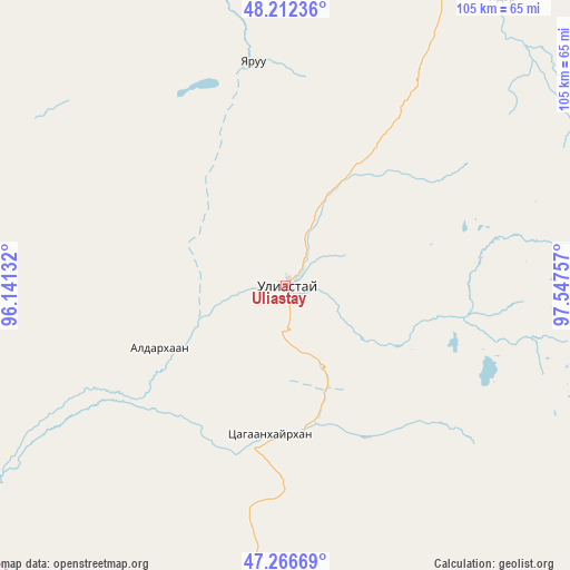
Uliastay GPS coordinates[2]
47° 44' 30.012" North, 96° 50' 39.984" East
| Map corner | latitude | longitude |
|---|---|---|
| Upper-left | 48.21236°, | 96.14132° |
| Center: | 47.74167°, | 96.84444° |
| Lower-right: | 47.26669°, | 97.54757° |
| Map W x H: | 105.1×105.1 km | = 65.3×65.3mi |
| max Lat: | 51.50725° ⇑48.2% North |
| Uliastay: | 47.74167° |
| min Lat: | ⇓51.8% South 42.84199° |
| min Long | Uliastay | max Long |
| 89.14358° | 96.84444° | 118.51014° |
| W 23.3%⇐ | ⇒76.7% E |
Elevation
Elevation of Uliastay is 1755 m = 5758 ft, and this is 338.5 m = 1111 ft above average elevation for this country.
| Max E: |
2800 m = 9186 ft | 22.1% |
| Uliastay | 1755 m 5758 ft | |
| Avg. | 1416.5 m = 4647 ft | |
Min E: |
619 m = 2031 ft | 77.9% |
See also: Mongolia elevation on elevation.city.
Geographical zone
Uliastay is located in North temperate zone (between Tropic of Cancer and the Arctic Circle). Distance of this North polar circle is 2092.8 km =1300.4 mi to North.| Distance of | km | miles | from Uliastay |
|---|---|---|---|
| North Pole | 4698.7 | 2919.6 | to North |
| Arctic Circle | 2092.8 | 1300.4 | to North |
| Tropic Cancer | 2702.5 | 1679.3 | to South |
| Equator | 5308.4 | 3298.5 | to South |


Nearby cities:
15 places around Uliastay: (largest is in red/bold)
• Aldar
25.5 km =15.8 mi,  244°
244°
• Altan
93.8 km =58.3 mi,  296°
296°
• Balgatay
96.4 km =59.9 mi,  166°
166°
• Bayanbulag
139.9 km =86.9 mi,  137°
137°
• Buga
138.4 km =86 mi,  265°
265°
• Buyanbat
109.5 km =68 mi,  219°
219°
• Buyant
82.1 km =51 mi, 135°
• Chandmanĭ
56 km =34.8 mi,  307°
307°
• Dzuunmod
66.2 km =41.1 mi,  36°
36°
• Hödrögö
126.1 km =78.4 mi,  3°
3°
• Shiree
27.4 km =17 mi,  186°
186°
• Tegsh
128.5 km =79.8 mi,  330°
330°
• Telmin Suma
115.5 km =71.8 mi,  29°
29°
• Tsagaan-Olom
116.8 km =72.6 mi, 191°
• Tsagaanchuluut
71.2 km =44.2 mi, 190°
Sources, notices
• [Note1] Compared only with cities in Mongolia existing in our database
• [Src1] Map data: © OpenStreetMap contributors (CC-BY-SA)
• [Src2] Other city data from geonames.org with taken over terms of usage.
• [Src3] Geographical zone / Annual Mean Temperature by Robert A. Rohde @ Wikipedia
