Buyanbat geodata
Buyanbat (Govĭ-Altay) is a seat of a second-order administrative division; located in Mongolia in Asia/Hovd (GMT+7) time zone. In our database, there are 33 cities with bigger population. Compared to other cities in Mongolia, 61.7% of cities are located further ↑North; 81% of cities are located further →East and 65.6% of cities have lower elevation than Buyanbat. Note1


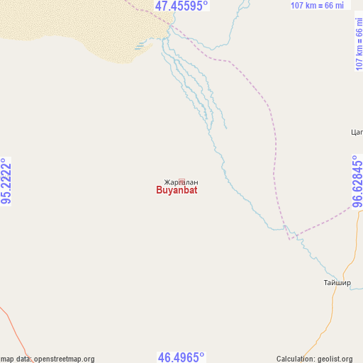
Buyanbat GPS coordinates[2]
46° 58' 42.168" North, 95° 55' 31.152" East
| Map corner | latitude | longitude |
|---|---|---|
| Upper-left | 47.45595°, | 95.2222° |
| Center: | 46.97838°, | 95.92532° |
| Lower-right: | 46.4965°, | 96.62845° |
| Map W x H: | 106.7×106.7 km | = 66.3×66.3mi |
| max Lat: | 51.50725° ⇑61.7% North |
| Buyanbat: | 46.97838° |
| min Lat: | ⇓38.3% South 42.84199° |
| min Long | Buyanbat | max Long |
| 89.14358° | 95.92532° | 118.51014° |
| W 19%⇐ | ⇒81% E |
Elevation
Elevation of Buyanbat is 1538 m = 5046 ft, and this is 121.5 m = 399 ft above average elevation for this country.
| Max E: |
2800 m = 9186 ft | 34.4% |
| Buyanbat | 1538 m 5046 ft | |
| Avg. | 1416.5 m = 4647 ft | |
Min E: |
619 m = 2031 ft | 65.6% |
See also: Mongolia elevation on elevation.city.
Geographical zone
Buyanbat is located in North temperate zone (between Tropic of Cancer and the Arctic Circle). Distance of this North polar circle is 2177.7 km =1353.2 mi to North.| Distance of | km | miles | from Buyanbat |
|---|---|---|---|
| North Pole | 4783.6 | 2972.4 | to North |
| Arctic Circle | 2177.7 | 1353.2 | to North |
| Tropic Cancer | 2617.6 | 1626.5 | to South |
| Equator | 5223.5 | 3245.7 | to South |


Nearby cities:
15 places around Buyanbat: (largest is in red/bold)
• Aldar
87 km =54.1 mi,  31°
31°
• Altai
72 km =44.7 mi,  159°
159°
• Altan
127.5 km =79.2 mi,  352°
352°
• Balgatay
93.4 km =58 mi,  95°
95°
• Bayan
55.1 km =34.2 mi,  271°
271°
• Buga
102.2 km =63.5 mi,  316°
316°
• Buyant
129.9 km =80.7 mi,  78°
78°
• Chandmanĭ
121.6 km =75.6 mi,  11°
11°
• Haliun
118 km =73.3 mi,  171°
171°
• Sayn-Ust
114 km =70.8 mi,  291°
291°
• Sharga
95.3 km =59.2 mi,  211°
211°
• Shiree
87.9 km =54.6 mi,  48°
48°
• Tsagaan-Olom
54.4 km =33.8 mi,  122°
122°
• Tsagaanchuluut
58.5 km =36.4 mi, 75°
• Uliastay
109.5 km =68 mi,  39°
39°
Sources, notices
• [Note1] Compared only with cities in Mongolia existing in our database
• [Src1] Map data: © OpenStreetMap contributors (CC-BY-SA)
• [Src2] Other city data from geonames.org with taken over terms of usage.
• [Src3] Geographical zone / Annual Mean Temperature by Robert A. Rohde @ Wikipedia
