Shiree geodata
Shiree (Dzabkhan) is a seat of a second-order administrative division; located in Mongolia in Asia/Hovd (GMT+7) time zone. In our database, there are 33 cities with bigger population. Compared to other cities in Mongolia, 52.5% of cities are located further ↑North; 77% of cities are located further →East and 82.2% of cities have lower elevation than Shiree. Note1


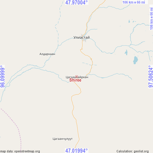
Shiree GPS coordinates[2]
47° 29' 49.704" North, 96° 48' 11.196" East
| Map corner | latitude | longitude |
|---|---|---|
| Upper-left | 47.97004°, | 96.09999° |
| Center: | 47.49714°, | 96.80311° |
| Lower-right: | 47.01994°, | 97.50624° |
| Map W x H: | 105.6×105.6 km | = 65.6×65.6mi |
| max Lat: | 51.50725° ⇑52.5% North |
| Shiree: | 47.49714° |
| min Lat: | ⇓47.5% South 42.84199° |
| min Long | Shiree | max Long |
| 89.14358° | 96.80311° | 118.51014° |
| W 23%⇐ | ⇒77% E |
Elevation
Elevation of Shiree is 1828 m = 5997 ft, and this is 411.5 m = 1350 ft above average elevation for this country.
| Max E: |
2800 m = 9186 ft | 17.8% |
| Shiree | 1828 m 5997 ft | |
| Avg. | 1416.5 m = 4647 ft | |
Min E: |
619 m = 2031 ft | 82.2% |
See also: Mongolia elevation on elevation.city.
Geographical zone
Shiree is located in North temperate zone (between Tropic of Cancer and the Arctic Circle). Distance of this North polar circle is 2120 km =1317.3 mi to North.| Distance of | km | miles | from Shiree |
|---|---|---|---|
| North Pole | 4725.9 | 2936.5 | to North |
| Arctic Circle | 2120 | 1317.3 | to North |
| Tropic Cancer | 2675.3 | 1662.4 | to South |
| Equator | 5281.2 | 3281.6 | to South |


Nearby cities:
15 places around Shiree: (largest is in red/bold)
• Aldar
25.7 km =16 mi,  308°
308°
• Altai
131.7 km =81.8 mi,  198°
198°
• Altan
106.4 km =66.1 mi, 310°
• Balgatay
71.4 km =44.4 mi,  158°
158°
• Bayan
133.4 km =82.9 mi,  245°
245°
• Bayanbulag
123.7 km =76.9 mi,  128°
128°
• Buga
136.3 km =84.7 mi,  277°
277°
• Buyanbat
87.9 km =54.6 mi,  228°
228°
• Buyant
68.3 km =42.4 mi,  117°
117°
• Chandmanĭ
74.1 km =46 mi,  326°
326°
• Dzuunmod
91 km =56.5 mi,  27°
27°
• Taygan
134.2 km =83.4 mi, 161°
• Tsagaan-Olom
89.6 km =55.7 mi,  193°
193°
• Tsagaanchuluut
44 km =27.3 mi, 193°
• Uliastay
27.4 km =17 mi,  6°
6°
Sources, notices
• [Note1] Compared only with cities in Mongolia existing in our database
• [Src1] Map data: © OpenStreetMap contributors (CC-BY-SA)
• [Src2] Other city data from geonames.org with taken over terms of usage.
• [Src3] Geographical zone / Annual Mean Temperature by Robert A. Rohde @ Wikipedia
