Hödrögö geodata
Hödrögö (Dzabkhan) is a seat of a second-order administrative division; located in Mongolia in Asia/Hovd (GMT+7) time zone. In our database, there are 33 cities with bigger population. Compared to other cities in Mongolia, 74.2% of cities are located further ↓South; 76.4% of cities are located further →East and 83.1% of cities have lower elevation than Hödrögö. Note1


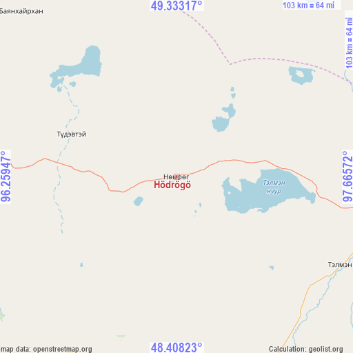
Hödrögö GPS coordinates[2]
48° 52' 22.224" North, 96° 57' 45.324" East
| Map corner | latitude | longitude |
|---|---|---|
| Upper-left | 49.33317°, | 96.25947° |
| Center: | 48.87284°, | 96.96259° |
| Lower-right: | 48.40823°, | 97.66572° |
| Map W x H: | 102.8×102.8 km | = 63.9×63.9mi |
| max Lat: | 51.50725° ⇑25.8% North |
| Hödrögö: | 48.87284° |
| min Lat: | ⇓74.2% South 42.84199° |
| min Long | Hödrögö | max Long |
| 89.14358° | 96.96259° | 118.51014° |
| W 23.6%⇐ | ⇒76.4% E |
Elevation
Elevation of Hödrögö is 1850 m = 6070 ft, and this is 433.5 m = 1422 ft above average elevation for this country.
| Max E: |
2800 m = 9186 ft | 16.9% |
| Hödrögö | 1850 m 6070 ft | |
| Avg. | 1416.5 m = 4647 ft | |
Min E: |
619 m = 2031 ft | 83.1% |
See also: Mongolia elevation on elevation.city.
Geographical zone
Hödrögö is located in North temperate zone (between Tropic of Cancer and the Arctic Circle). Distance of this North polar circle is 1967 km =1222.2 mi to North.| Distance of | km | miles | from Hödrögö |
|---|---|---|---|
| North Pole | 4572.9 | 2841.5 | to North |
| Arctic Circle | 1967 | 1222.2 | to North |
| Tropic Cancer | 2828.2 | 1757.4 | to South |
| Equator | 5434.2 | 3376.7 | to South |


Nearby cities:
15 places around Hödrögö: (largest is in red/bold)
• Altan
124.5 km =77.4 mi,  227°
227°
• Altanbulag
66.1 km =41.1 mi,  316°
316°
• Altay
102.2 km =63.5 mi,  334°
334°
• Asgat
71.9 km =44.7 mi,  350°
350°
• Chandmanĭ
105.5 km =65.6 mi,  209°
209°
• Dzuunmod
78.7 km =48.9 mi,  157°
157°
• Dzür
121.7 km =75.6 mi, 315°
• Halban
92.3 km =57.4 mi,  37°
37°
• Holboo
116.6 km =72.5 mi,  254°
254°
• Jargalant
120.4 km =74.8 mi,  293°
293°
• Oygon
33.1 km =20.6 mi, 292°
• Tegsh
71.8 km =44.6 mi,  259°
259°
• Telmin Suma
54.5 km =33.9 mi,  118°
118°
• Tosontsengel
97.6 km =60.6 mi,  97°
97°
• Uliastay
126.1 km =78.4 mi,  183°
183°
Sources, notices
• [Note1] Compared only with cities in Mongolia existing in our database
• [Src1] Map data: © OpenStreetMap contributors (CC-BY-SA)
• [Src2] Other city data from geonames.org with taken over terms of usage.
• [Src3] Geographical zone / Annual Mean Temperature by Robert A. Rohde @ Wikipedia
