Dzuunmod geodata
Dzuunmod (Dzabkhan) is a seat of a second-order administrative division; located in Mongolia in Asia/Hovd (GMT+7) time zone. In our database, there are 33 cities with bigger population. Compared to other cities in Mongolia, 61.7% of cities are located further ↓South; 75.2% of cities are located further →East and 88.3% of cities have lower elevation than Dzuunmod. Note1


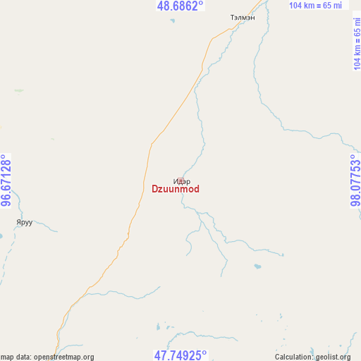
Dzuunmod GPS coordinates[2]
48° 13' 11.532" North, 97° 22' 27.84" East
| Map corner | latitude | longitude |
|---|---|---|
| Upper-left | 48.6862°, | 96.67128° |
| Center: | 48.21987°, | 97.3744° |
| Lower-right: | 47.74925°, | 98.07753° |
| Map W x H: | 104.2×104.2 km | = 64.7×64.7mi |
| max Lat: | 51.50725° ⇑38.3% North |
| Dzuunmod: | 48.21987° |
| min Lat: | ⇓61.7% South 42.84199° |
| min Long | Dzuunmod | max Long |
| 89.14358° | 97.3744° | 118.51014° |
| W 24.8%⇐ | ⇒75.2% E |
Elevation
Elevation of Dzuunmod is 1962 m = 6437 ft, and this is 545.5 m = 1790 ft above average elevation for this country.
| Max E: |
2800 m = 9186 ft | 11.7% |
| Dzuunmod | 1962 m 6437 ft | |
| Avg. | 1416.5 m = 4647 ft | |
Min E: |
619 m = 2031 ft | 88.3% |
See also: Mongolia elevation on elevation.city.
Geographical zone
Dzuunmod is located in North temperate zone (between Tropic of Cancer and the Arctic Circle). Distance of this North polar circle is 2039.6 km =1267.3 mi to North.| Distance of | km | miles | from Dzuunmod |
|---|---|---|---|
| North Pole | 4645.5 | 2886.6 | to North |
| Arctic Circle | 2039.6 | 1267.3 | to North |
| Tropic Cancer | 2755.6 | 1712.2 | to South |
| Equator | 5361.5 | 3331.5 | to South |


Nearby cities:
15 places around Dzuunmod: (largest is in red/bold)
• Aldar
89.5 km =55.6 mi,  224°
224°
• Altan
123.5 km =76.7 mi,  264°
264°
• Bayan-Uhaa
118.3 km =73.5 mi,  62°
62°
• Buyant
113.4 km =70.5 mi,  171°
171°
• Chandmanĭ
85.5 km =53.1 mi, 257°
• Hödrögö
78.7 km =48.9 mi,  337°
337°
• Höviyn Am
141.8 km =88.1 mi,  140°
140°
• Oygon
104.8 km =65.1 mi,  324°
324°
• Shiree
91 km =56.5 mi,  207°
207°
• Tegsh
117.3 km =72.9 mi,  300°
300°
• Telmin Suma
50.4 km =31.3 mi,  20°
20°
• Tosontsengel
89.7 km =55.7 mi,  48°
48°
• Tsagaanchuluut
134 km =83.3 mi,  203°
203°
• Tsahir
110.7 km =68.8 mi,  98°
98°
• Uliastay
66.2 km =41.1 mi, 216°
Sources, notices
• [Note1] Compared only with cities in Mongolia existing in our database
• [Src1] Map data: © OpenStreetMap contributors (CC-BY-SA)
• [Src2] Other city data from geonames.org with taken over terms of usage.
• [Src3] Geographical zone / Annual Mean Temperature by Robert A. Rohde @ Wikipedia
