Rashaant geodata
Rashaant (Bayan-Ölgiy) is a seat of a second-order administrative division; located in Mongolia in Asia/Hovd (GMT+7) time zone. In our database, there are 33 cities with bigger population. Compared to other cities in Mongolia, 52.5% of cities are located further ↓South; 96.3% of cities are located further →East and 91.4% of cities have lower elevation than Rashaant. Note1


Rashaant GPS coordinates[2]
47° 46' 0.012" North, 90° 49' 59.988" East
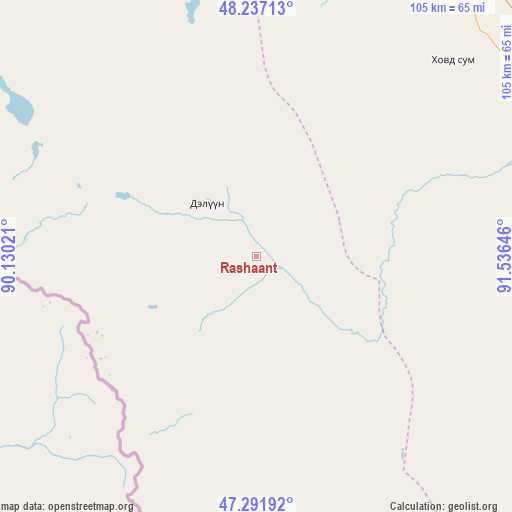
| Map corner | latitude | longitude |
|---|---|---|
| Upper-left | 48.23713°, | 90.13021° |
| Center: | 47.76667°, | 90.83333° |
| Lower-right: | 47.29192°, | 91.53646° |
| Map W x H: | 105.1×105.1 km | = 65.3×65.3mi |
| max Lat: | 51.50725° ⇑47.5% North |
| Rashaant: | 47.76667° |
| min Lat: | ⇓52.5% South 42.84199° |
| min Long | Rashaant | max Long |
| 89.14358° | 90.83333° | 118.51014° |
| W 3.7%⇐ | ⇒96.3% E |
Elevation
Elevation of Rashaant is 2052 m = 6732 ft, and this is 635.5 m = 2085 ft above average elevation for this country.
| Max E: |
2800 m = 9186 ft | 8.6% |
| Rashaant | 2052 m 6732 ft | |
| Avg. | 1416.5 m = 4647 ft | |
Min E: |
619 m = 2031 ft | 91.4% |
See also: Mongolia elevation on elevation.city.
Geographical zone
Rashaant is located in North temperate zone (between Tropic of Cancer and the Arctic Circle). Distance of this North polar circle is 2090 km =1298.7 mi to North.| Distance of | km | miles | from Rashaant |
|---|---|---|---|
| North Pole | 4695.9 | 2917.9 | to North |
| Arctic Circle | 2090 | 1298.7 | to North |
| Tropic Cancer | 2705.2 | 1680.9 | to South |
| Equator | 5311.2 | 3300.2 | to South |


Nearby cities:
15 places around Rashaant: (largest is in red/bold)
• Bayanhoshuu
95.9 km =59.6 mi,  57°
57°
• Buga
145.8 km =90.6 mi,  334°
334°
• Buyant
80.5 km =50 mi,  65°
65°
• Buyant
131.4 km =81.6 mi,  313°
313°
• Chihertey
114.7 km =71.3 mi,  301°
301°
• Duut
66.1 km =41.1 mi,  114°
114°
• Har-Us
91.3 km =56.7 mi,  29°
29°
• Jargalant
95.3 km =59.2 mi,  168°
168°
• Khovd
65.9 km =40.9 mi, 66°
• Tolbo
83 km =51.6 mi, 330°
• Tsagaantüngi
145.5 km =90.4 mi,  348°
348°
• Tsenher
135.2 km =84 mi,  134°
134°
• Tögrög
111 km =69 mi, 110°
• Ulaan Khat
77.8 km =48.3 mi,  287°
287°
• Urdgol
135.9 km =84.4 mi,  86°
86°
Sources, notices
• [Note1] Compared only with cities in Mongolia existing in our database
• [Src1] Map data: © OpenStreetMap contributors (CC-BY-SA)
• [Src2] Other city data from geonames.org with taken over terms of usage.
• [Src3] Geographical zone / Annual Mean Temperature by Robert A. Rohde @ Wikipedia
