Duut geodata
Duut (Hovd) is a seat of a second-order administrative division; located in Mongolia in Asia/Hovd (GMT+7) time zone. In our database, there are 33 cities with bigger population. Compared to other cities in Mongolia, 52.1% of cities are located further ↑North; 94.5% of cities are located further →East and 97.9% of cities have lower elevation than Duut. Note1


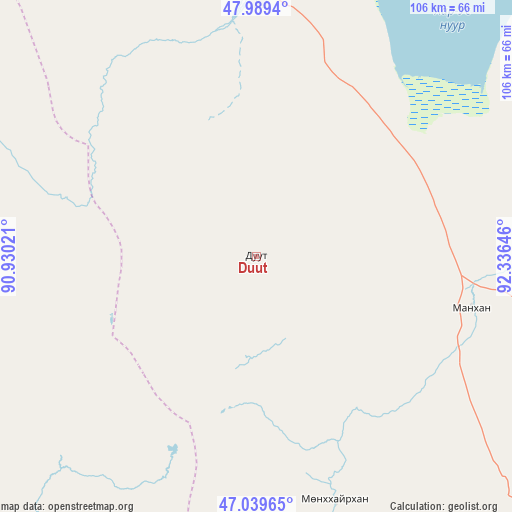
Duut GPS coordinates[2]
47° 31' 0.012" North, 91° 37' 59.988" East
| Map corner | latitude | longitude |
|---|---|---|
| Upper-left | 47.9894°, | 90.93021° |
| Center: | 47.51667°, | 91.63333° |
| Lower-right: | 47.03965°, | 92.33646° |
| Map W x H: | 105.6×105.6 km | = 65.6×65.6mi |
| max Lat: | 51.50725° ⇑52.1% North |
| Duut: | 47.51667° |
| min Lat: | ⇓47.9% South 42.84199° |
| min Long | Duut | max Long |
| 89.14358° | 91.63333° | 118.51014° |
| W 5.5%⇐ | ⇒94.5% E |
Elevation
Elevation of Duut is 2297 m = 7536 ft, and this is 880.5 m = 2889 ft above average elevation for this country.
| Max E: |
2800 m = 9186 ft | 2.1% |
| Duut | 2297 m 7536 ft | |
| Avg. | 1416.5 m = 4647 ft | |
Min E: |
619 m = 2031 ft | 97.9% |
See also: Mongolia elevation on elevation.city.
Geographical zone
Duut is located in North temperate zone (between Tropic of Cancer and the Arctic Circle). Distance of this North polar circle is 2117.8 km =1315.9 mi to North.| Distance of | km | miles | from Duut |
|---|---|---|---|
| North Pole | 4723.7 | 2935.2 | to North |
| Arctic Circle | 2117.8 | 1315.9 | to North |
| Tropic Cancer | 2677.4 | 1663.7 | to South |
| Equator | 5283.4 | 3283 | to South |


Nearby cities:
15 places around Duut: (largest is in red/bold)
• Altanteel
101.8 km =63.3 mi,  116°
116°
• Bayanhoshuu
82.4 km =51.2 mi,  14°
14°
• Buyant
62.7 km =39 mi, 12°
• Bürenhayrhan
158.5 km =98.5 mi,  182°
182°
• Har-Us
108.5 km =67.4 mi,  352°
352°
• Jargalant
77.5 km =48.2 mi,  212°
212°
• Khovd
54.4 km =33.8 mi,  0°
0°
• Rashaant
66.1 km =41.1 mi,  294°
294°
• Tolbo
141.8 km =88.1 mi,  314°
314°
• Tsenher
76 km =47.2 mi,  151°
151°
• Tsetsegnuur
160.3 km =99.6 mi,  129°
129°
• Tögrög
45.6 km =28.3 mi,  103°
103°
• Ulaan Khat
143.6 km =89.2 mi, 291°
• Ulaantolgoy
127.1 km =79 mi,  136°
136°
• Urdgol
83.9 km =52.1 mi,  65°
65°
Sources, notices
• [Note1] Compared only with cities in Mongolia existing in our database
• [Src1] Map data: © OpenStreetMap contributors (CC-BY-SA)
• [Src2] Other city data from geonames.org with taken over terms of usage.
• [Src3] Geographical zone / Annual Mean Temperature by Robert A. Rohde @ Wikipedia
