Urdgol geodata
Urdgol (Hovd) is a seat of a second-order administrative division; located in Mongolia in Asia/Hovd (GMT+7) time zone. In our database, there are 33 cities with bigger population. Compared to other cities in Mongolia, 53.7% of cities are located further ↓South; 89.9% of cities are located further →East and 64.7% of cities have lower elevation than Urdgol. Note1


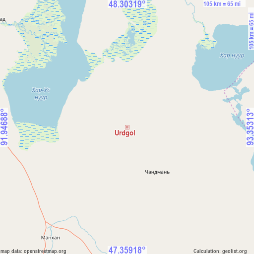
Urdgol GPS coordinates[2]
47° 49' 59.988" North, 92° 39' 0" East
| Map corner | latitude | longitude |
|---|---|---|
| Upper-left | 48.30319°, | 91.94688° |
| Center: | 47.83333°, | 92.65° |
| Lower-right: | 47.35918°, | 93.35313° |
| Map W x H: | 105×105 km | = 65.2×65.2mi |
| max Lat: | 51.50725° ⇑46.3% North |
| Urdgol: | 47.83333° |
| min Lat: | ⇓53.7% South 42.84199° |
| min Long | Urdgol | max Long |
| 89.14358° | 92.65° | 118.51014° |
| W 10.1%⇐ | ⇒89.9% E |
Elevation
Elevation of Urdgol is 1520 m = 4987 ft, and this is 103.5 m = 340 ft above average elevation for this country.
| Max E: |
2800 m = 9186 ft | 35.3% |
| Urdgol | 1520 m 4987 ft | |
| Avg. | 1416.5 m = 4647 ft | |
Min E: |
619 m = 2031 ft | 64.7% |
See also: Mongolia elevation on elevation.city.
Geographical zone
Urdgol is located in North temperate zone (between Tropic of Cancer and the Arctic Circle). Distance of this North polar circle is 2082.6 km =1294.1 mi to North.| Distance of | km | miles | from Urdgol |
|---|---|---|---|
| North Pole | 4688.5 | 2913.3 | to North |
| Arctic Circle | 2082.6 | 1294.1 | to North |
| Tropic Cancer | 2712.6 | 1685.5 | to South |
| Equator | 5318.6 | 3304.8 | to South |


Nearby cities:
15 places around Urdgol: (largest is in red/bold)
• Altanteel
81.7 km =50.8 mi,  169°
169°
• Bayanhoshuu
70.4 km =43.7 mi,  309°
309°
• Buyant
67.3 km =41.8 mi,  292°
292°
• Darvi
123.4 km =76.7 mi,  143°
143°
• Duut
83.9 km =52.1 mi,  245°
245°
• Har-Us
115.6 km =71.8 mi, 308°
• Har-Us
141 km =87.6 mi,  341°
341°
• Hungiy
143.7 km =89.3 mi,  58°
58°
• Khovd
77.5 km =48.2 mi,  284°
284°
• Rashaant
135.9 km =84.4 mi,  266°
266°
• Sharbulag
114.3 km =71 mi,  16°
16°
• Tsenher
109.5 km =68 mi,  201°
201°
• Tsetsegnuur
144.8 km =90 mi,  161°
161°
• Tögrög
55.6 km =34.5 mi,  215°
215°
• Ulaantolgoy
128.3 km =79.7 mi,  175°
175°
Sources, notices
• [Note1] Compared only with cities in Mongolia existing in our database
• [Src1] Map data: © OpenStreetMap contributors (CC-BY-SA)
• [Src2] Other city data from geonames.org with taken over terms of usage.
• [Src3] Geographical zone / Annual Mean Temperature by Robert A. Rohde @ Wikipedia
