Tsenher geodata
Tsenher (Hovd) is a seat of a second-order administrative division; located in Mongolia in Asia/Hovd (GMT+7) time zone. In our database, there are 33 cities with bigger population. Compared to other cities in Mongolia, 63.5% of cities are located further ↑North; 91.4% of cities are located further →East and 100% of cities have lower elevation than Tsenher. Note1


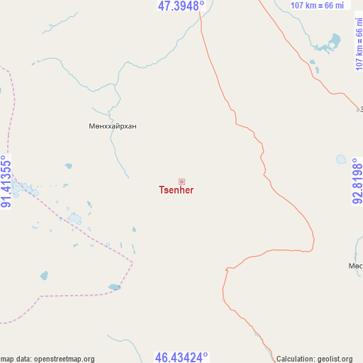
Tsenher GPS coordinates[2]
46° 55' 0.012" North, 92° 7' 0.012" East
| Map corner | latitude | longitude |
|---|---|---|
| Upper-left | 47.3948°, | 91.41355° |
| Center: | 46.91667°, | 92.11667° |
| Lower-right: | 46.43424°, | 92.8198° |
| Map W x H: | 106.8×106.8 km | = 66.4×66.4mi |
| max Lat: | 51.50725° ⇑63.5% North |
| Tsenher: | 46.91667° |
| min Lat: | ⇓36.5% South 42.84199° |
| min Long | Tsenher | max Long |
| 89.14358° | 92.11667° | 118.51014° |
| W 8.6%⇐ | ⇒91.4% E |
Elevation
Elevation of Tsenher is 2800 m = 9186 ft, and this is 1383.5 m = 4539 ft above average elevation for this country.
| Max E: |
2800 m = 9186 ft | 0% |
| Tsenher | 2800 m 9186 ft | |
| Avg. | 1416.5 m = 4647 ft | |
Min E: |
619 m = 2031 ft | 100% |
See also: Mongolia elevation on elevation.city.
Geographical zone
Tsenher is located in North temperate zone (between Tropic of Cancer and the Arctic Circle). Distance of this North polar circle is 2184.5 km =1357.4 mi to North.| Distance of | km | miles | from Tsenher |
|---|---|---|---|
| North Pole | 4790.4 | 2976.6 | to North |
| Arctic Circle | 2184.5 | 1357.4 | to North |
| Tropic Cancer | 2610.7 | 1622.2 | to South |
| Equator | 5216.6 | 3241.4 | to South |


Nearby cities:
15 places around Tsenher: (largest is in red/bold)
• Altanteel
59.2 km =36.8 mi,  68°
68°
• Altay sumu
124.8 km =77.5 mi,  174°
174°
• Bayanhoshuu
147.2 km =91.5 mi,  354°
354°
• Buyant
129.8 km =80.7 mi, 350°
• Bürenhayrhan
101.5 km =63.1 mi,  205°
205°
• Darvi
113.9 km =70.8 mi,  88°
88°
• Duut
76 km =47.2 mi,  331°
331°
• Jargalant
78.1 km =48.5 mi,  270°
270°
• Khovd
126.2 km =78.4 mi,  343°
343°
• Rashaant
135.2 km =84 mi,  314°
314°
• Tsetsegnuur
94.4 km =58.7 mi,  111°
111°
• Tögrög
57 km =35.4 mi,  8°
8°
• Ulaantolgoy
57 km =35.4 mi,  117°
117°
• Urdgol
109.5 km =68 mi,  21°
21°
• Uyenchi Somon
96.7 km =60.1 mi,  184°
184°
Sources, notices
• [Note1] Compared only with cities in Mongolia existing in our database
• [Src1] Map data: © OpenStreetMap contributors (CC-BY-SA)
• [Src2] Other city data from geonames.org with taken over terms of usage.
• [Src3] Geographical zone / Annual Mean Temperature by Robert A. Rohde @ Wikipedia
