Jargalant geodata
Jargalant (Bayan-Ölgiy) is a seat of a second-order administrative division; located in Mongolia in Asia/Hovd (GMT+7) time zone. In our database, there are 33 cities with bigger population. Compared to other cities in Mongolia, 62.9% of cities are located further ↑North; 95.7% of cities are located further →East and 86.5% of cities have lower elevation than Jargalant. Note1


Jargalant GPS coordinates[2]
46° 55' 36.12" North, 91° 5' 16.152" East
| Map corner | latitude | longitude |
|---|---|---|
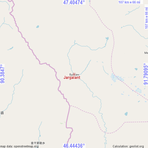
| Upper-left | 47.40474°, | 90.3847° |
| Center: | 46.9267°, | 91.08782° |
| Lower-right: | 46.44436°, | 91.79095° |
| Map W x H: | 106.8×106.8 km | = 66.4×66.4mi |
| max Lat: | 51.50725° ⇑62.9% North |
| Jargalant: | 46.9267° |
| min Lat: | ⇓37.1% South 42.84199° |
| min Long | Jargalant | max Long |
| 89.14358° | 91.08782° | 118.51014° |
| W 4.3%⇐ | ⇒95.7% E |
Elevation
Elevation of Jargalant is 1929 m = 6329 ft, and this is 512.5 m = 1681 ft above average elevation for this country.
| Max E: |
2800 m = 9186 ft | 13.5% |
| Jargalant | 1929 m 6329 ft | |
| Avg. | 1416.5 m = 4647 ft | |
Min E: |
619 m = 2031 ft | 86.5% |
See also: Mongolia elevation on elevation.city.
Geographical zone
Jargalant is located in North temperate zone (between Tropic of Cancer and the Arctic Circle). Distance of this North polar circle is 2183.4 km =1356.7 mi to North.| Distance of | km | miles | from Jargalant |
|---|---|---|---|
| North Pole | 4789.3 | 2975.9 | to North |
| Arctic Circle | 2183.4 | 1356.7 | to North |
| Tropic Cancer | 2611.8 | 1622.9 | to South |
| Equator | 5217.8 | 3242.2 | to South |


Nearby cities:
15 places around Jargalant: (largest is in red/bold)
• Altanteel
134.7 km =83.7 mi,  81°
81°
• Altay sumu
155.3 km =96.5 mi,  143°
143°
• Bayanhoshuu
158 km =98.2 mi,  23°
23°
• Buyant
138.1 km =85.8 mi, 23°
• Bürenhayrhan
99.2 km =61.6 mi,  159°
159°
• Duut
77.5 km =48.2 mi,  32°
32°
• Khovd
127 km =78.9 mi, 19°
• Rashaant
95.3 km =59.2 mi,  348°
348°
• Tsenher
78.1 km =48.5 mi,  90°
90°
• Tsetsegnuur
169.9 km =105.6 mi,  102°
102°
• Tögrög
102.2 km =63.5 mi,  57°
57°
• Ulaan Khat
150.2 km =93.3 mi,  321°
321°
• Ulaantolgoy
131.8 km =81.9 mi, 101°
• Urdgol
154.9 km =96.3 mi,  49°
49°
• Uyenchi Somon
120.7 km =75 mi, 143°
Sources, notices
• [Note1] Compared only with cities in Mongolia existing in our database
• [Src1] Map data: © OpenStreetMap contributors (CC-BY-SA)
• [Src2] Other city data from geonames.org with taken over terms of usage.
• [Src3] Geographical zone / Annual Mean Temperature by Robert A. Rohde @ Wikipedia
