Oygon geodata
Oygon (Dzabkhan) is a seat of a second-order administrative division; located in Mongolia in Asia/Hovd (GMT+7) time zone. In our database, there are 33 cities with bigger population. Compared to other cities in Mongolia, 76.7% of cities are located further ↓South; 78.2% of cities are located further →East and 78.8% of cities have lower elevation than Oygon. Note1


Oygon GPS coordinates[2]
48° 59' 8.232" North, 96° 32' 36.204" East
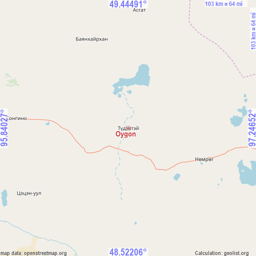
| Map corner | latitude | longitude |
|---|---|---|
| Upper-left | 49.44491°, | 95.84027° |
| Center: | 48.98562°, | 96.54339° |
| Lower-right: | 48.52206°, | 97.24652° |
| Map W x H: | 102.6×102.6 km | = 63.8×63.8mi |
| max Lat: | 51.50725° ⇑23.3% North |
| Oygon: | 48.98562° |
| min Lat: | ⇓76.7% South 42.84199° |
| min Long | Oygon | max Long |
| 89.14358° | 96.54339° | 118.51014° |
| W 21.8%⇐ | ⇒78.2% E |
Elevation
Elevation of Oygon is 1766 m = 5794 ft, and this is 349.5 m = 1147 ft above average elevation for this country.
| Max E: |
2800 m = 9186 ft | 21.2% |
| Oygon | 1766 m 5794 ft | |
| Avg. | 1416.5 m = 4647 ft | |
Min E: |
619 m = 2031 ft | 78.8% |
See also: Mongolia elevation on elevation.city.
Geographical zone
Oygon is located in North temperate zone (between Tropic of Cancer and the Arctic Circle). Distance of this North polar circle is 1954.5 km =1214.5 mi to North.| Distance of | km | miles | from Oygon |
|---|---|---|---|
| North Pole | 4560.4 | 2833.7 | to North |
| Arctic Circle | 1954.5 | 1214.5 | to North |
| Tropic Cancer | 2840.8 | 1765.2 | to South |
| Equator | 5446.7 | 3384.4 | to South |


Nearby cities:
15 places around Oygon: (largest is in red/bold)
• Altan
114.2 km =71 mi,  212°
212°
• Altanbulag
38.6 km =24 mi,  337°
337°
• Altay
80.9 km =50.3 mi,  350°
350°
• Asgat
61.3 km =38.1 mi,  17°
17°
• Chandmanĭ
106.3 km =66.1 mi,  191°
191°
• Dzuunmod
104.8 km =65.1 mi,  144°
144°
• Dzür
92.4 km =57.4 mi,  323°
323°
• Halban
105.8 km =65.7 mi,  55°
55°
• Holboo
92.6 km =57.5 mi,  241°
241°
• Hödrögö
33.1 km =20.6 mi,  112°
112°
• Jargalant
87.3 km =54.2 mi,  294°
294°
• Nuga
128.5 km =79.8 mi,  234°
234°
• Tegsh
47.5 km =29.5 mi, 236°
• Telmin Suma
87.5 km =54.4 mi,  115°
115°
• Tsetserleg
126.6 km =78.7 mi,  284°
284°
Sources, notices
• [Note1] Compared only with cities in Mongolia existing in our database
• [Src1] Map data: © OpenStreetMap contributors (CC-BY-SA)
• [Src2] Other city data from geonames.org with taken over terms of usage.
• [Src3] Geographical zone / Annual Mean Temperature by Robert A. Rohde @ Wikipedia
