Asgat geodata
Asgat (Dzabkhan) is a seat of a second-order administrative division; located in Mongolia in Asia/Hovd (GMT+7) time zone. In our database, there are 33 cities with bigger population. Compared to other cities in Mongolia, 87.4% of cities are located further ↓South; 77.3% of cities are located further →East and 75.2% of cities have lower elevation than Asgat. Note1


Asgat GPS coordinates[2]
49° 30' 38.952" North, 96° 47' 57.984" East
| Map corner | latitude | longitude |
|---|---|---|
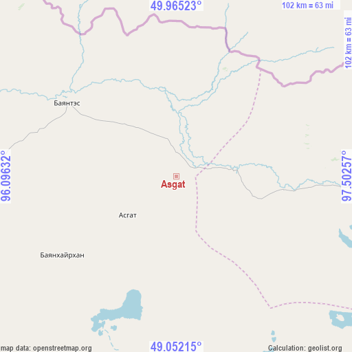
| Upper-left | 49.96523°, | 96.09632° |
| Center: | 49.51082°, | 96.79944° |
| Lower-right: | 49.05215°, | 97.50257° |
| Map W x H: | 101.5×101.5 km | = 63.1×63.1mi |
| max Lat: | 51.50725° ⇑12.6% North |
| Asgat: | 49.51082° |
| min Lat: | ⇓87.4% South 42.84199° |
| min Long | Asgat | max Long |
| 89.14358° | 96.79944° | 118.51014° |
| W 22.7%⇐ | ⇒77.3% E |
Elevation
Elevation of Asgat is 1702 m = 5584 ft, and this is 285.5 m = 937 ft above average elevation for this country.
| Max E: |
2800 m = 9186 ft | 24.8% |
| Asgat | 1702 m 5584 ft | |
| Avg. | 1416.5 m = 4647 ft | |
Min E: |
619 m = 2031 ft | 75.2% |
See also: Mongolia elevation on elevation.city.
Geographical zone
Asgat is located in North temperate zone (between Tropic of Cancer and the Arctic Circle). Distance of this North polar circle is 1896.1 km =1178.2 mi to North.| Distance of | km | miles | from Asgat |
|---|---|---|---|
| North Pole | 4502 | 2797.4 | to North |
| Arctic Circle | 1896.1 | 1178.2 | to North |
| Tropic Cancer | 2899.2 | 1801.5 | to South |
| Equator | 5505.1 | 3420.7 | to South |


Nearby cities:
15 places around Asgat: (largest is in red/bold)
• Altanbulag
40.1 km =24.9 mi,  235°
235°
• Altay
38.3 km =23.8 mi,  303°
303°
• Chandmanĭ
167.3 km =104 mi,  193°
193°
• Dzuunmod
149.6 km =93 mi,  163°
163°
• Dzür
74.4 km =46.2 mi,  282°
282°
• Halban
68 km =42.3 mi,  88°
88°
• Holboo
142.9 km =88.8 mi,  224°
224°
• Hödrögö
71.9 km =44.7 mi,  170°
170°
• Jargalant
100.4 km =62.4 mi,  256°
256°
• Oygon
61.3 km =38.1 mi,  197°
197°
• Sharga
147.5 km =91.7 mi,  77°
77°
• Tegsh
102.5 km =63.7 mi,  214°
214°
• Telmin Suma
113.5 km =70.5 mi,  148°
148°
• Tosontsengel
136.7 km =84.9 mi,  127°
127°
• Tsetserleg
143 km =88.9 mi, 259°
Sources, notices
• [Note1] Compared only with cities in Mongolia existing in our database
• [Src1] Map data: © OpenStreetMap contributors (CC-BY-SA)
• [Src2] Other city data from geonames.org with taken over terms of usage.
• [Src3] Geographical zone / Annual Mean Temperature by Robert A. Rohde @ Wikipedia
