Halban geodata
Halban (Hövsgöl) is a seat of a second-order administrative division; located in Mongolia in Asia/Ulaanbaatar (GMT+8) time zone. In our database, there are 33 cities with bigger population. Compared to other cities in Mongolia, 87.7% of cities are located further ↓South; 74.2% of cities are located further →East and 77.6% of cities have lower elevation than Halban. Note1


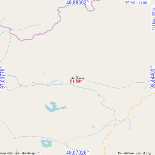
Halban GPS coordinates[2]
49° 31' 43.572" North, 97° 44' 27.24" East
| Map corner | latitude | longitude |
|---|---|---|
| Upper-left | 49.98302°, | 97.03778° |
| Center: | 49.52877°, | 97.7409° |
| Lower-right: | 49.07026°, | 98.44403° |
| Map W x H: | 101.5×101.5 km | = 63.1×63.1mi |
| max Lat: | 51.50725° ⇑12.3% North |
| Halban: | 49.52877° |
| min Lat: | ⇓87.7% South 42.84199° |
| min Long | Halban | max Long |
| 89.14358° | 97.7409° | 118.51014° |
| W 25.8%⇐ | ⇒74.2% E |
Elevation
Elevation of Halban is 1752 m = 5748 ft, and this is 335.5 m = 1101 ft above average elevation for this country.
| Max E: |
2800 m = 9186 ft | 22.4% |
| Halban | 1752 m 5748 ft | |
| Avg. | 1416.5 m = 4647 ft | |
Min E: |
619 m = 2031 ft | 77.6% |
See also: Mongolia elevation on elevation.city.
Geographical zone
Halban is located in North temperate zone (between Tropic of Cancer and the Arctic Circle). Distance of this North polar circle is 1894.1 km =1176.9 mi to North.| Distance of | km | miles | from Halban |
|---|---|---|---|
| North Pole | 4500 | 2796.2 | to North |
| Arctic Circle | 1894.1 | 1176.9 | to North |
| Tropic Cancer | 2901.2 | 1802.7 | to South |
| Equator | 5507.1 | 3422 | to South |


Nearby cities:
15 places around Halban: (largest is in red/bold)
• Altanbulag
104.1 km =64.7 mi,  256°
256°
• Altay
101.4 km =63 mi,  281°
281°
• Altraga
114.1 km =70.9 mi,  50°
50°
• Asgat
68 km =42.3 mi,  268°
268°
• Bayan
134.7 km =83.7 mi,  94°
94°
• Bayan-Uhaa
118.1 km =73.4 mi,  139°
139°
• Dzuunmod
148 km =92 mi,  190°
190°
• Dzür
141.1 km =87.7 mi, 275°
• Erdenet
145.4 km =90.3 mi,  116°
116°
• Hödrögö
92.3 km =57.4 mi,  217°
217°
• Mandal
128.5 km =79.8 mi,  71°
71°
• Oygon
105.8 km =65.7 mi,  235°
235°
• Sharga
82 km =51 mi, 68°
• Telmin Suma
98.9 km =61.5 mi, 185°
• Tosontsengel
94.5 km =58.7 mi,  155°
155°
Sources, notices
• [Note1] Compared only with cities in Mongolia existing in our database
• [Src1] Map data: © OpenStreetMap contributors (CC-BY-SA)
• [Src2] Other city data from geonames.org with taken over terms of usage.
• [Src3] Geographical zone / Annual Mean Temperature by Robert A. Rohde @ Wikipedia
