Hunt geodata
Hunt (Arhangay) is a seat of a second-order administrative division; located in Mongolia in Asia/Ulaanbaatar (GMT+8) time zone. In our database, there are 33 cities with bigger population. Compared to other cities in Mongolia, 54.6% of cities are located further ↓South; 68.1% of cities are located further →East and 93.9% of cities have lower elevation than Hunt. Note1


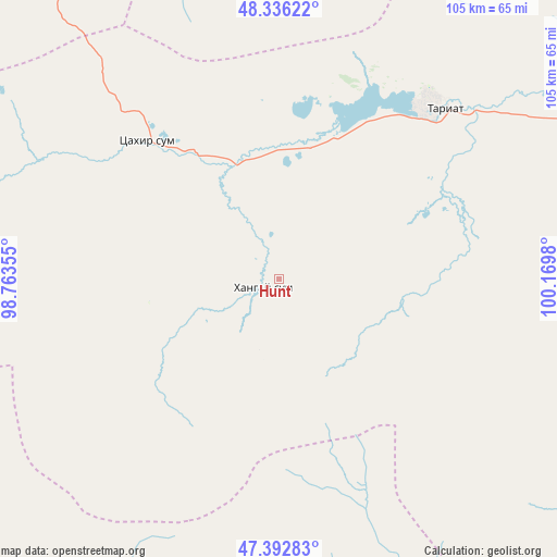
Hunt GPS coordinates[2]
47° 52' 0.012" North, 99° 28' 0.012" East
| Map corner | latitude | longitude |
|---|---|---|
| Upper-left | 48.33622°, | 98.76355° |
| Center: | 47.86667°, | 99.46667° |
| Lower-right: | 47.39283°, | 100.1698° |
| Map W x H: | 104.9×104.9 km | = 65.2×65.2mi |
| max Lat: | 51.50725° ⇑45.4% North |
| Hunt: | 47.86667° |
| min Lat: | ⇓54.6% South 42.84199° |
| min Long | Hunt | max Long |
| 89.14358° | 99.46667° | 118.51014° |
| W 31.9%⇐ | ⇒68.1% E |
Elevation
Elevation of Hunt is 2130 m = 6988 ft, and this is 713.5 m = 2341 ft above average elevation for this country.
| Max E: |
2800 m = 9186 ft | 6.1% |
| Hunt | 2130 m 6988 ft | |
| Avg. | 1416.5 m = 4647 ft | |
Min E: |
619 m = 2031 ft | 93.9% |
See also: Mongolia elevation on elevation.city.
Geographical zone
Hunt is located in North temperate zone (between Tropic of Cancer and the Arctic Circle). Distance of this North polar circle is 2078.9 km =1291.8 mi to North.| Distance of | km | miles | from Hunt |
|---|---|---|---|
| North Pole | 4684.8 | 2911 | to North |
| Arctic Circle | 2078.9 | 1291.8 | to North |
| Tropic Cancer | 2716.4 | 1687.9 | to South |
| Equator | 5322.3 | 3307.1 | to South |


Nearby cities:
15 places around Hunt: (largest is in red/bold)
• Bayan-Uhaa
107.1 km =66.5 mi,  332°
332°
• Bayanhongor
136.9 km =85.1 mi,  159°
159°
• Bayantsagaan
135.7 km =84.3 mi,  44°
44°
• Dzaanhoshuu
113.5 km =70.5 mi,  111°
111°
• Dzag
105.2 km =65.4 mi,  192°
192°
• Erdenet
120.4 km =74.8 mi,  2°
2°
• Horgo
44.6 km =27.7 mi, 42°
• Höviyn Am
97.5 km =60.6 mi,  223°
223°
• Ider
105.2 km =65.4 mi,  16°
16°
• Jargalant
67.3 km =41.8 mi,  123°
123°
• Jargalant
80.7 km =50.1 mi,  171°
171°
• Orgil
80.6 km =50.1 mi,  353°
353°
• Teel
80.2 km =49.8 mi,  75°
75°
• Tosontsengel
132.1 km =82.1 mi,  318°
318°
• Tsahir
51.5 km =32 mi,  297°
297°
Sources, notices
• [Note1] Compared only with cities in Mongolia existing in our database
• [Src1] Map data: © OpenStreetMap contributors (CC-BY-SA)
• [Src2] Other city data from geonames.org with taken over terms of usage.
• [Src3] Geographical zone / Annual Mean Temperature by Robert A. Rohde @ Wikipedia
