Nouakchott geodata
Nouakchott is a capital of a political entity; located in Mauritania in Africa/Nouakchott (GMT+0) time zone. With population of 661,400 people, there are 0 cities with bigger population in this country. Compared to other cities in Mauritania, 57.9% of cities are located further ↓South; 89.5% of cities are located further →East and 78.9% of cities have higher elevation than Nouakchott. Note1


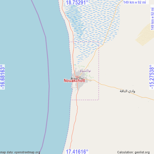
Nouakchott GPS coordinates[2]
18° 5' 8.916" North, 15° 58' 42.6" West
| Map corner | latitude | longitude |
|---|---|---|
| Upper-left | 18.75291°, | -16.68163° |
| Center: | 18.08581°, | -15.9785° |
| Lower-right: | 17.41616°, | -15.27538° |
| Map W x H: | 148.6×148.6 km | = 92.3×92.3mi |
| max Lat: | 22.73542° ⇑42.1% North |
| Nouakchott: | 18.08581° |
| min Lat: | ⇓57.9% South 15.15846° |
| min Long | Nouakchott | max Long |
| -17.03842° | -15.9785° | -7.25649° |
| W 10.5%⇐ | ⇒89.5% E |
Elevation
Elevation of Nouakchott is 10 m = 33 ft, and this is 116.1 m = 381 ft below average elevation for this country.
| Max E: |
500 m = 1640 ft | 78.9% |
| Avg. | 126.1 m = 414 ft | |
| Nouakchott | 10 m = 33 ft | |
Min E: |
1 m = 3 ft | 21.1% |
See also: Nouakchott elevation on elevation.city.
Geographical zone
Nouakchott is located in North Torrid zone (between Equator and Tropic of Cancer). Distance of this Northern Tropic circle is 595 km =369.7 mi to North.| Distance of | km | miles | from Nouakchott |
|---|---|---|---|
| North Pole | 7996.1 | 4968.5 | to North |
| Arctic Circle | 5390.2 | 3349.3 | to North |
| Tropic Cancer | 595 | 369.7 | to North |
| Equator | 2011 | 1249.6 | to South |


Nearby cities:
12 places around Nouakchott: (largest is in red/bold)
• Akjoujt
249.4 km =155 mi,  42°
42°
• Aleg
247.2 km =153.6 mi,  117°
117°
• Arafat
4.4 km =2.7 mi,  171°
171°
• Atar
409.4 km =254.4 mi,  48°
48°
• Barkéwol
402.7 km =250.2 mi,  113°
113°
• Dar Naim
6 km =3.7 mi,  65°
65°
• Kaédi
339.8 km =211.1 mi,  129°
129°
• Nouadhibou
336.4 km =209 mi,  340°
340°
• Rosso
175.8 km =109.2 mi, 173°
• Tevragh Zeina
1.8 km =1.1 mi,  324°
324°
• Tékane
178 km =110.6 mi,  157°
157°
• ’Elb el Jmel
244.1 km =151.7 mi, 119°
Sources, notices
• [Note1] Compared only with cities in Mauritania existing in our database
• [Src1] Map data: © OpenStreetMap contributors (CC-BY-SA)
• [Src2] Other city data from geonames.org with taken over terms of usage.
• [Src3] Geographical zone / Annual Mean Temperature by Robert A. Rohde @ Wikipedia
