Tevragh Zeina geodata
Tevragh Zeina (Nouakchott Ouest) is a seat of a first-order administrative division; located in Mauritania in Africa/Nouakchott (GMT+0) time zone. In our database, there are 17 cities with bigger population. Compared to other cities in Mauritania, 63.2% of cities are located further ↓South; 94.7% of cities are located further →East and 100% of cities have higher elevation than Tevragh Zeina. Note1


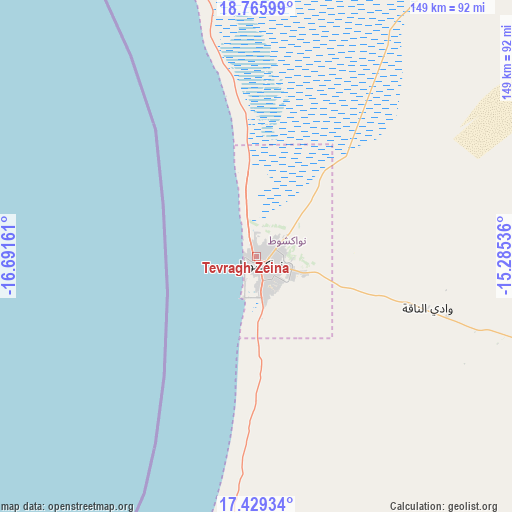
Tevragh Zeina GPS coordinates[2]
18° 5' 56.184" North, 15° 59' 18.528" West
| Map corner | latitude | longitude |
|---|---|---|
| Upper-left | 18.76599°, | -16.69161° |
| Center: | 18.09894°, | -15.98848° |
| Lower-right: | 17.42934°, | -15.28536° |
| Map W x H: | 148.6×148.6 km | = 92.3×92.3mi |
| max Lat: | 22.73542° ⇑36.8% North |
| Tevragh Zeina: | 18.09894° |
| min Lat: | ⇓63.2% South 15.15846° |
| min Long | Tevragh Zeina | max Long |
| -17.03842° | -15.98848° | -7.25649° |
| W 5.3%⇐ | ⇒94.7% E |
Elevation
Elevation of Tevragh Zeina is 1 m = 3 ft, and this is 125.1 m = 410 ft below average elevation for this country.
| Max E: |
500 m = 1640 ft | 100% |
| Avg. | 126.1 m = 414 ft | |
| Tevragh Zeina | 1 m = 3 ft | |
Min E: |
1 m = 3 ft | 0% |
See also: Mauritania elevation on elevation.city.
Geographical zone
Tevragh Zeina is located in North Torrid zone (between Equator and Tropic of Cancer). Distance of this Northern Tropic circle is 593.5 km =368.8 mi to North.| Distance of | km | miles | from Tevragh Zeina |
|---|---|---|---|
| North Pole | 7994.6 | 4967.6 | to North |
| Arctic Circle | 5388.8 | 3348.4 | to North |
| Tropic Cancer | 593.5 | 368.8 | to North |
| Equator | 2012.4 | 1250.4 | to South |


Nearby cities:
12 places around Tevragh Zeina: (largest is in red/bold)
• Akjoujt
249 km =154.7 mi,  42°
42°
• Aleg
248.8 km =154.6 mi,  117°
117°
• Arafat
6.1 km =3.8 mi,  163°
163°
• Atar
409.2 km =254.3 mi,  48°
48°
• Barkéwol
404.3 km =251.2 mi,  113°
113°
• Dar Naim
6.6 km =4.1 mi,  81°
81°
• Kaédi
341.5 km =212.2 mi,  129°
129°
• Nouadhibou
334.7 km =208 mi,  340°
340°
• Nouakchott
1.8 km =1.1 mi,  144°
144°
• Rosso
177.3 km =110.2 mi,  173°
173°
• Tékane
179.8 km =111.7 mi, 157°
• ’Elb el Jmel
245.7 km =152.7 mi, 119°
Sources, notices
• [Note1] Compared only with cities in Mauritania existing in our database
• [Src1] Map data: © OpenStreetMap contributors (CC-BY-SA)
• [Src2] Other city data from geonames.org with taken over terms of usage.
• [Src3] Geographical zone / Annual Mean Temperature by Robert A. Rohde @ Wikipedia
