Akjoujt geodata
Akjoujt (Inchiri) is a seat of a first-order administrative division; located in Mauritania in Africa/Nouakchott (GMT+0) time zone. With population of 11,500 people, there are 12 cities with bigger population in this country. Compared to other cities in Mauritania, 78.9% of cities are located further ↓South; 63.2% of cities are located further →East and 63.2% of cities have lower elevation than Akjoujt. Note1


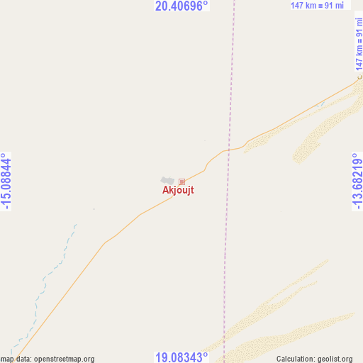
Akjoujt GPS coordinates[2]
19° 44' 47.652" North, 14° 23' 7.116" West
| Map corner | latitude | longitude |
|---|---|---|
| Upper-left | 20.40696°, | -15.08844° |
| Center: | 19.74657°, | -14.38531° |
| Lower-right: | 19.08343°, | -13.68219° |
| Map W x H: | 147.2×147.2 km | = 91.5×91.5mi |
| max Lat: | 22.73542° ⇑21.1% North |
| Akjoujt: | 19.74657° |
| min Lat: | ⇓78.9% South 15.15846° |
| min Long | Akjoujt | max Long |
| -17.03842° | -14.38531° | -7.25649° |
| W 36.8%⇐ | ⇒63.2% E |
Elevation
Elevation of Akjoujt is 121 m = 397 ft, and this is 5.1 m = 17 ft below average elevation for this country.
| Max E: |
500 m = 1640 ft | 36.8% |
| Avg. | 126.1 m = 414 ft | |
| Akjoujt | 121 m = 397 ft | |
Min E: |
1 m = 3 ft | 63.2% |
See also: Mauritania elevation on elevation.city.
Geographical zone
Akjoujt is located in North Torrid zone (between Equator and Tropic of Cancer). Distance of this Northern Tropic circle is 410.3 km =254.9 mi to North.| Distance of | km | miles | from Akjoujt |
|---|---|---|---|
| North Pole | 7811.4 | 4853.8 | to North |
| Arctic Circle | 5205.6 | 3234.6 | to North |
| Tropic Cancer | 410.3 | 254.9 | to North |
| Equator | 2195.6 | 1364.3 | to South |


Nearby cities:
15 places around Akjoujt: (largest is in red/bold)
• Aleg
303.6 km =188.6 mi,  170°
170°
• Arafat
252.2 km =156.7 mi,  221°
221°
• Atar
163.8 km =101.8 mi,  58°
58°
• Barkéwol
398.7 km =247.7 mi,  150°
150°
• Chingueṭṭi
225.8 km =140.3 mi,  69°
69°
• Dar Naim
243.9 km =151.6 mi, 221°
• Kaédi
410.6 km =255.1 mi, 166°
• Nouadhibou
306.9 km =190.7 mi,  295°
295°
• Nouakchott
249.4 km =155 mi, 222°
• Rosso
389.5 km =242 mi,  202°
202°
• Tevragh Zeina
249 km =154.7 mi, 222°
• Tidjikja
337.7 km =209.8 mi,  113°
113°
• Tékane
364.2 km =226.3 mi, 196°
• Zouerate
387 km =240.5 mi,  30°
30°
• ’Elb el Jmel
307.3 km =190.9 mi, 171°
Sources, notices
• [Note1] Compared only with cities in Mauritania existing in our database
• [Src1] Map data: © OpenStreetMap contributors (CC-BY-SA)
• [Src2] Other city data from geonames.org with taken over terms of usage.
• [Src3] Geographical zone / Annual Mean Temperature by Robert A. Rohde @ Wikipedia
