Guraidhoo geodata
Guraidhoo (Kaafu Atoll) is a populated place; located in Maldives in Indian/Maldives (GMT+5) time zone. With population of 1,800 people, there are 14 cities with bigger population in this country. Compared to other cities in Maldives, 60.7% of cities are located further ↓South; 78.6% of cities are located further ←West and 100% of cities have higher elevation than Guraidhoo. Note1


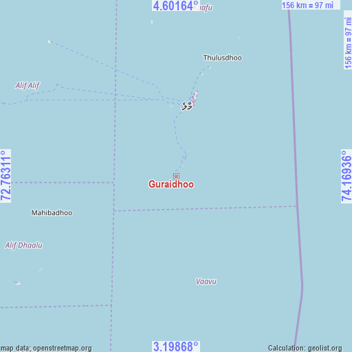
Guraidhoo GPS coordinates[2]
3° 54' 1.62" North, 73° 27' 58.428" East
| Map corner | latitude | longitude |
|---|---|---|
| Upper-left | 4.60164°, | 72.76311° |
| Center: | 3.90045°, | 73.46623° |
| Lower-right: | 3.19868°, | 74.16936° |
| Map W x H: | 156×156 km | = 96.9×96.9mi |
| max Lat: | 6.88744° ⇑39.3% North |
| Guraidhoo: | 3.90045° |
| min Lat: | ⇓60.7% South -0.6° |
| min Long | Guraidhoo | max Long |
| 72.89437° | 73.46623° | 73.56667° |
| W 78.6%⇐ | ⇒21.4% E |
Elevation
Elevation of Guraidhoo is -1 m = -3 ft, and this is 8.3 m = 27 ft below average elevation for this country.
| Max E: |
12 m = 39 ft | 100% |
| Avg. | 7.3 m = 24 ft | |
| Guraidhoo | -1 m = -3 ft | |
Min E: |
-1 m = -3 ft | 0% |
See also: Maldives elevation on elevation.city.
Geographical zone
Guraidhoo is located in North Torrid zone (between Equator and Tropic of Cancer). Distance of Equator is 433.7 km =269.5 mi to South.| Distance of | km | miles | from Guraidhoo |
|---|---|---|---|
| North Pole | 9573.4 | 5948.6 | to North |
| Arctic Circle | 6967.5 | 4329.4 | to North |
| Tropic Cancer | 2172.2 | 1349.7 | to North |
| Equator | 433.7 | 269.5 | to South |


Nearby cities:
15 places around Guraidhoo: (largest is in red/bold)
• Buruni
154.4 km =95.9 mi,  194°
194°
• Diyamigili
174 km =108.1 mi,  184°
184°
• Eydhafushi
140.7 km =87.4 mi,  341°
341°
• Felidhoo
48.5 km =30.1 mi,  169°
169°
• Guraidhoo
176 km =109.4 mi, 185°
• Hulhumale
35.6 km =22.1 mi,  13°
13°
• Kudahuvadhoo
150.7 km =93.6 mi,  204°
204°
• Maafushi
5.4 km =3.4 mi,  30°
30°
• Madifushi
172.2 km =107 mi, 184°
• Mahibadhoo
57.4 km =35.7 mi,  253°
253°
• Male
30.9 km =19.2 mi, 8°
• Muli
110 km =68.4 mi, 174°
• Naifaru
172 km =106.9 mi,  356°
356°
• Open Stage
140.9 km =87.6 mi, 341°
• Vilufushi
156.4 km =97.2 mi, 186°
Sources, notices
• [Note1] Compared only with cities in Maldives existing in our database
• [Src1] Map data: © OpenStreetMap contributors (CC-BY-SA)
• [Src2] Other city data from geonames.org with taken over terms of usage.
• [Src3] Geographical zone / Annual Mean Temperature by Robert A. Rohde @ Wikipedia
