Naifaru geodata
Naifaru (Lhaviyani Atholhu) is a seat of a first-order administrative division; located in Maldives in Indian/Maldives (GMT+5) time zone. With population of 5,044 people, there are 5 cities with bigger population in this country. Compared to other cities in Maldives, 82.1% of cities are located further ↓South; 60.7% of cities are located further ←West and 85.7% of cities have higher elevation than Naifaru. Note1


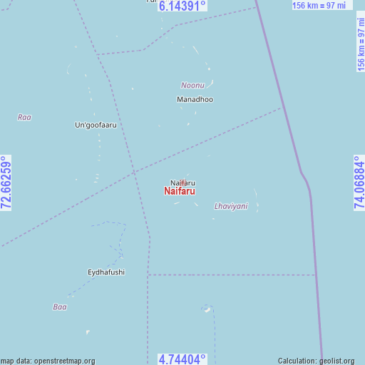
Naifaru GPS coordinates[2]
5° 26' 39.768" North, 73° 21' 56.556" East
| Map corner | latitude | longitude |
|---|---|---|
| Upper-left | 6.14391°, | 72.66259° |
| Center: | 5.44438°, | 73.36571° |
| Lower-right: | 4.74404°, | 74.06884° |
| Map W x H: | 155.7×155.7 km | = 96.7×96.7mi |
| max Lat: | 6.88744° ⇑17.9% North |
| Naifaru: | 5.44438° |
| min Lat: | ⇓82.1% South -0.6° |
| min Long | Naifaru | max Long |
| 72.89437° | 73.36571° | 73.56667° |
| W 60.7%⇐ | ⇒39.3% E |
Elevation
Elevation of Naifaru is 6 m = 20 ft, and this is 1.3 m = 4 ft below average elevation for this country.
| Max E: |
12 m = 39 ft | 85.7% |
| Avg. | 7.3 m = 24 ft | |
| Naifaru | 6 m = 20 ft | |
Min E: |
-1 m = -3 ft | 14.3% |
See also: Maldives elevation on elevation.city.
Geographical zone
Naifaru is located in North Torrid zone (between Equator and Tropic of Cancer). Distance of Equator is 605.4 km =376.2 mi to South.| Distance of | km | miles | from Naifaru |
|---|---|---|---|
| North Pole | 9401.7 | 5841.9 | to North |
| Arctic Circle | 6795.8 | 4222.7 | to North |
| Tropic Cancer | 2000.6 | 1243.1 | to North |
| Equator | 605.4 | 376.2 | to South |


Nearby cities:
15 places around Naifaru: (largest is in red/bold)
• Dhidhdhoo
162.8 km =101.2 mi,  350°
350°
• Eydhafushi
50 km =31.1 mi,  220°
220°
• Felidhoo
220.2 km =136.8 mi,  174°
174°
• Funadhoo
79 km =49.1 mi, 353°
• Guraidhoo
172 km =106.9 mi,  176°
176°
• Hulhumale
138.4 km =86 mi, 171°
• Kudahuvadhoo
312.8 km =194.4 mi,  189°
189°
• Kulhudhuffushi
135 km =83.9 mi, 345°
• Maafushi
167.6 km =104.1 mi, 175°
• Mahibadhoo
192.7 km =119.7 mi, 193°
• Male
142 km =88.2 mi, 173°
• Manadhoo
36.2 km =22.5 mi,  8°
8°
• Muli
281.9 km =175.2 mi, 175°
• Open Stage
49.9 km =31 mi, 220°
• Ugoofaaru
44.7 km =27.8 mi,  303°
303°
Sources, notices
• [Note1] Compared only with cities in Maldives existing in our database
• [Src1] Map data: © OpenStreetMap contributors (CC-BY-SA)
• [Src2] Other city data from geonames.org with taken over terms of usage.
• [Src3] Geographical zone / Annual Mean Temperature by Robert A. Rohde @ Wikipedia
