San José Vista Hermosa geodata
San José Vista Hermosa (Morelos) is a populated place; located in Mexico in America/Mexico_City (GMT-6) time zone. With population of 4,447 people, there are 2068 cities with bigger population in this country. Compared to other cities in Mexico, 70.7% of cities are located further ↑North; 53.8% of cities are located further →East and 60% of cities have higher elevation than San José Vista Hermosa. Note1
Current local time in San José Vista Hermosa:
08:34 AM, WednesdayDifference from your time zone: hours


San José Vista Hermosa GPS coordinates[2]
18° 39' 15.948" North, 99° 15' 58.392" West
| Map corner | latitude | longitude |
|---|---|---|
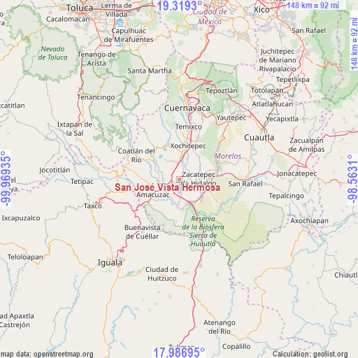
| Upper-left | 19.3193°, | -99.96935° |
| Center: | 18.65443°, | -99.26622° |
| Lower-right: | 17.98695°, | -98.5631° |
| Map W x H: | 148.1×148.1 km | = 92×92mi |
| max Lat: | 32.7° ⇑70.7% North |
| San José Vista Hermosa: | 18.65443° |
| min Lat: | ⇓29.3% South 14.53588° |
| min Long | San José Vista | max Long |
| -117.105° | -99.26622° | -86.73105° |
| W 46.2%⇐ | ⇒53.8% E |
Elevation
Elevation of San José Vista Hermosa is 1002 m = 3287 ft, and this is 251.7 m = 826 ft below average elevation for this country.
| Max E: |
3497 m = 11473 ft | 60% |
| Avg. | 1253.7 m = 4113 ft | |
| San José Vista Hermosa | 1002 m = 3287 ft | |
Min E: |
-1 m = -3 ft | 40% |
See also: Mexico elevation on elevation.city.
Geographical zone
San José Vista Hermosa is located in North Torrid zone (between Equator and Tropic of Cancer). Distance of this Northern Tropic circle is 531.7 km =330.4 mi to North.| Distance of | km | miles | from San José Vista Hermosa |
|---|---|---|---|
| North Pole | 7932.9 | 4929.3 | to North |
| Arctic Circle | 5327 | 3310 | to North |
| Tropic Cancer | 531.7 | 330.4 | to North |
| Equator | 2074.2 | 1288.8 | to South |


Nearby cities:
15 places around San José Vista Hermosa: (largest is in red/bold)
• 24 de Febrero
6.8 km =4.2 mi,  253°
253°
• Ahuehuetzingo
5.3 km =3.3 mi,  302°
302°
• Alpuyeca
9.5 km =5.9 mi,  4°
4°
• Ampliación Nicolás Bravo
6.6 km =4.1 mi,  119°
119°
• Colonia la Pintora
7.4 km =4.6 mi,  7°
7°
• El Coco
8.6 km =5.3 mi,  214°
214°
• El Estudiante
9.1 km =5.7 mi,  200°
200°
• Galeana
6 km =3.7 mi,  107°
107°
• Jicarero
6.3 km =3.9 mi,  134°
134°
• Puente de Ixtla
7 km =4.3 mi,  231°
231°
• San Antonio Chiverías
4.7 km =2.9 mi,  92°
92°
• Tequesquitengo
4.9 km =3 mi,  172°
172°
• Unidad Habitacional José María Morelos y Pavón
6.3 km =3.9 mi, 127°
• Xoxocotla
3.9 km =2.4 mi,  33°
33°
• Zacatepec
8 km =5 mi, 90°
Sources, notices
• [Note1] Compared only with cities in Mexico existing in our database
• [Src1] Map data: © OpenStreetMap contributors (CC-BY-SA)
• [Src2] Other city data from geonames.org with taken over terms of usage.
• [Src3] Geographical zone / Annual Mean Temperature by Robert A. Rohde @ Wikipedia
