Chicontla geodata
Chicontla (Puebla) is a populated place; located in Mexico in America/Mexico_City (GMT-6) time zone. With population of 3,305 people, there are 2752 cities with bigger population in this country. Compared to other cities in Mexico, 62.3% of cities are located further ↓South; 65.7% of cities are located further ←West and 72.1% of cities have higher elevation than Chicontla. Note1


Chicontla GPS coordinates[2]
20° 14' 38.472" North, 97° 49' 50.268" West
| Map corner | latitude | longitude |
|---|---|---|
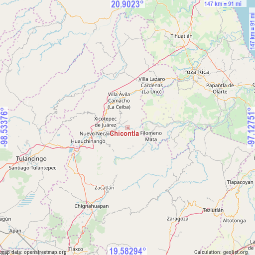
| Upper-left | 20.9023°, | -98.53376° |
| Center: | 20.24402°, | -97.83063° |
| Lower-right: | 19.58294°, | -97.12751° |
| Map W x H: | 146.7×146.7 km | = 91.2×91.2mi |
| max Lat: | 32.7° ⇑37.7% North |
| Chicontla: | 20.24402° |
| min Lat: | ⇓62.3% South 14.53588° |
| min Long | Chicontla | max Long |
| -117.105° | -97.83063° | -86.73105° |
| W 65.7%⇐ | ⇒34.3% E |
Elevation
Elevation of Chicontla is 325 m = 1066 ft, and this is 928.7 m = 3047 ft below average elevation for this country.
| Max E: |
3497 m = 11473 ft | 72.1% |
| Avg. | 1253.7 m = 4113 ft | |
| Chicontla | 325 m = 1066 ft | |
Min E: |
-1 m = -3 ft | 27.9% |
See also: Mexico elevation on elevation.city.
Geographical zone
Chicontla is located in North Torrid zone (between Equator and Tropic of Cancer). Distance of this Northern Tropic circle is 355 km =220.6 mi to North.| Distance of | km | miles | from Chicontla |
|---|---|---|---|
| North Pole | 7756.1 | 4819.4 | to North |
| Arctic Circle | 5150.3 | 3200.2 | to North |
| Tropic Cancer | 355 | 220.6 | to North |
| Equator | 2250.9 | 1398.6 | to South |


Nearby cities:
15 places around Chicontla: (largest is in red/bold)
• Ahuacatlaya
7.3 km =4.5 mi,  177°
177°
• Ahuaxintitla
6.9 km =4.3 mi,  278°
278°
• Atequexquitla
6.8 km =4.2 mi,  289°
289°
• Cinco de Octubre
2 km =1.2 mi,  274°
274°
• El Encinal
3.1 km =1.9 mi,  217°
217°
• La Unión
4.7 km =2.9 mi, 294°
• Mazacoatlán
9.7 km =6 mi,  257°
257°
• Ocomantla
6.6 km =4.1 mi, 270°
• Patla
2.4 km =1.5 mi, 281°
• San Pedro Tlaolantongo
3.3 km =2.1 mi,  115°
115°
• Tecpatlán
3.9 km =2.4 mi, 262°
• Telolotla
9.1 km =5.7 mi,  247°
247°
• Tlaxcalantongo
8.9 km =5.5 mi,  330°
330°
• Xochinanacatlán
8.9 km =5.5 mi,  231°
231°
• Zihuateutla
6 km =3.7 mi, 277°
Sources, notices
• [Note1] Compared only with cities in Mexico existing in our database
• [Src1] Map data: © OpenStreetMap contributors (CC-BY-SA)
• [Src2] Other city data from geonames.org with taken over terms of usage.
• [Src3] Geographical zone / Annual Mean Temperature by Robert A. Rohde @ Wikipedia
