Tlamatoca geodata
Tlamatoca (Veracruz) is a populated place; located in Mexico in America/Mexico_City (GMT-6) time zone. With population of 1,479 people, there are 5833 cities with bigger population in this country. Compared to other cities in Mexico, 63.2% of cities are located further ↑North; 75.7% of cities are located further ←West and 59% of cities have higher elevation than Tlamatoca. Note1


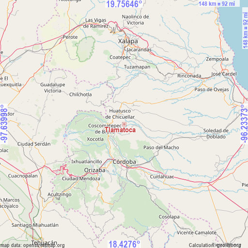
Tlamatoca GPS coordinates[2]
19° 5' 36.096" North, 96° 56' 12.66" West
| Map corner | latitude | longitude |
|---|---|---|
| Upper-left | 19.75646°, | -97.63998° |
| Center: | 19.09336°, | -96.93685° |
| Lower-right: | 18.4276°, | -96.23373° |
| Map W x H: | 147.8×147.8 km | = 91.8×91.8mi |
| max Lat: | 32.7° ⇑63.2% North |
| Tlamatoca: | 19.09336° |
| min Lat: | ⇓36.8% South 14.53588° |
| min Long | Tlamatoca | max Long |
| -117.105° | -96.93685° | -86.73105° |
| W 75.7%⇐ | ⇒24.3% E |
Elevation
Elevation of Tlamatoca is 1051 m = 3448 ft, and this is 202.7 m = 665 ft below average elevation for this country.
| Max E: |
3497 m = 11473 ft | 59% |
| Avg. | 1253.7 m = 4113 ft | |
| Tlamatoca | 1051 m = 3448 ft | |
Min E: |
-1 m = -3 ft | 41% |
See also: Mexico elevation on elevation.city.
Geographical zone
Tlamatoca is located in North Torrid zone (between Equator and Tropic of Cancer). Distance of this Northern Tropic circle is 482.9 km =300.1 mi to North.| Distance of | km | miles | from Tlamatoca |
|---|---|---|---|
| North Pole | 7884.1 | 4899 | to North |
| Arctic Circle | 5278.2 | 3279.7 | to North |
| Tropic Cancer | 482.9 | 300.1 | to North |
| Equator | 2123 | 1319.2 | to South |


Nearby cities:
15 places around Tlamatoca: (largest is in red/bold)
• Alta Luz
1.6 km =1 mi,  238°
238°
• Amatiopa
2.2 km =1.4 mi,  343°
343°
• Capulapa
5.2 km =3.2 mi,  82°
82°
• Colonia Francisco I. Madero
7.4 km =4.6 mi,  299°
299°
• El Triunfo
7.4 km =4.6 mi,  108°
108°
• Huatusco
7 km =4.3 mi,  332°
332°
• Ixcatla
2.8 km =1.7 mi,  136°
136°
• Ixhuatlán del Café
6.8 km =4.2 mi,  226°
226°
• Ixpila
4.2 km =2.6 mi,  311°
311°
• Mesa del Rancho
4 km =2.5 mi, 341°
• Michapa
2.3 km =1.4 mi, 306°
• Ocotitlán
6.4 km =4 mi,  152°
152°
• Presidio
4.6 km =2.9 mi, 234°
• Tlaltengo
7.2 km =4.5 mi,  259°
259°
• Zacamitla
4.9 km =3 mi,  164°
164°
Sources, notices
• [Note1] Compared only with cities in Mexico existing in our database
• [Src1] Map data: © OpenStreetMap contributors (CC-BY-SA)
• [Src2] Other city data from geonames.org with taken over terms of usage.
• [Src3] Geographical zone / Annual Mean Temperature by Robert A. Rohde @ Wikipedia
