Ixhuatlán del Café geodata
Ixhuatlán del Café (Veracruz) is a seat of a second-order administrative division; located in Mexico in America/Mexico_City (GMT-6) time zone. With population of 6,649 people, there are 1408 cities with bigger population in this country. Compared to other cities in Mexico, 63.9% of cities are located further ↑North; 75% of cities are located further ←West and 51.6% of cities have higher elevation than Ixhuatlán del Café. Note1


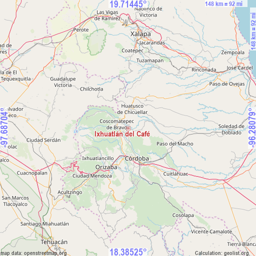
Ixhuatlán del Café GPS coordinates[2]
19° 3' 4.248" North, 96° 59' 2.076" West
| Map corner | latitude | longitude |
|---|---|---|
| Upper-left | 19.71445°, | -97.68704° |
| Center: | 19.05118°, | -96.98391° |
| Lower-right: | 18.38525°, | -96.28079° |
| Map W x H: | 147.8×147.8 km | = 91.8×91.8mi |
| max Lat: | 32.7° ⇑63.9% North |
| Ixhuatlán del Café: | 19.05118° |
| min Lat: | ⇓36.1% South 14.53588° |
| min Long | Ixhuatlán del | max Long |
| -117.105° | -96.98391° | -86.73105° |
| W 75%⇐ | ⇒25% E |
Elevation
Elevation of Ixhuatlán del Café is 1355 m = 4446 ft, and this is 101.3 m = 332 ft above average elevation for this country.
| Max E: |
3497 m = 11473 ft | 51.6% |
| Ixhuatlán del Café | 1355 m 4446 ft | |
| Avg. | 1253.7 m = 4113 ft | |
Min E: |
-1 m = -3 ft | 48.4% |
See also: Mexico elevation on elevation.city.
Geographical zone
Ixhuatlán del Café is located in North Torrid zone (between Equator and Tropic of Cancer). Distance of this Northern Tropic circle is 487.6 km =303 mi to North.| Distance of | km | miles | from Ixhuatlán del Café |
|---|---|---|---|
| North Pole | 7888.8 | 4901.9 | to North |
| Arctic Circle | 5282.9 | 3282.6 | to North |
| Tropic Cancer | 487.6 | 303 | to North |
| Equator | 2118.3 | 1316.3 | to South |


Nearby cities:
15 places around Ixhuatlán del Café: (largest is in red/bold)
• Alta Luz
5.2 km =3.2 mi,  42°
42°
• Calaquioco
5.8 km =3.6 mi,  246°
246°
• Chocamán
6.7 km =4.2 mi,  229°
229°
• Ixcapantla
3.2 km =2 mi,  153°
153°
• Lázaro Cárdenas
5.9 km =3.7 mi,  306°
306°
• Michapa
6.8 km =4.2 mi,  27°
27°
• Presidio
2.4 km =1.5 mi, 31°
• San José Neria
6.6 km =4.1 mi,  194°
194°
• Tecama
5.3 km =3.3 mi,  181°
181°
• Tecamilla
6 km =3.7 mi, 181°
• Tlaltengo
4 km =2.5 mi,  328°
328°
• Tlamatoca
6.8 km =4.2 mi,  46°
46°
• Tomatlán
3.5 km =2.2 mi, 230°
• Xalatlaco
6 km =3.7 mi,  268°
268°
• Zacamitla
6.3 km =3.9 mi,  90°
90°
Sources, notices
• [Note1] Compared only with cities in Mexico existing in our database
• [Src1] Map data: © OpenStreetMap contributors (CC-BY-SA)
• [Src2] Other city data from geonames.org with taken over terms of usage.
• [Src3] Geographical zone / Annual Mean Temperature by Robert A. Rohde @ Wikipedia
