Alta Luz geodata
Alta Luz (Veracruz) is a populated place; located in Mexico in America/Mexico_City (GMT-6) time zone. With population of 655 people, there are 13244 cities with bigger population in this country. Compared to other cities in Mexico, 63.3% of cities are located further ↑North; 75.5% of cities are located further ←West and 56.3% of cities have higher elevation than Alta Luz. Note1


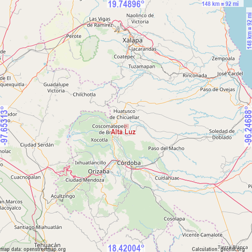
Alta Luz GPS coordinates[2]
19° 5' 8.988" North, 96° 57' 0" West
| Map corner | latitude | longitude |
|---|---|---|
| Upper-left | 19.74896°, | -97.65313° |
| Center: | 19.08583°, | -96.95° |
| Lower-right: | 18.42004°, | -96.24688° |
| Map W x H: | 147.8×147.8 km | = 91.8×91.8mi |
| max Lat: | 32.7° ⇑63.3% North |
| Alta Luz: | 19.08583° |
| min Lat: | ⇓36.7% South 14.53588° |
| min Long | Alta Luz | max Long |
| -117.105° | -96.95° | -86.73105° |
| W 75.5%⇐ | ⇒24.5% E |
Elevation
Elevation of Alta Luz is 1147 m = 3763 ft, and this is 106.7 m = 350 ft below average elevation for this country.
| Max E: |
3497 m = 11473 ft | 56.3% |
| Avg. | 1253.7 m = 4113 ft | |
| Alta Luz | 1147 m = 3763 ft | |
Min E: |
-1 m = -3 ft | 43.7% |
See also: Mexico elevation on elevation.city.
Geographical zone
Alta Luz is located in North Torrid zone (between Equator and Tropic of Cancer). Distance of this Northern Tropic circle is 483.8 km =300.6 mi to North.| Distance of | km | miles | from Alta Luz |
|---|---|---|---|
| North Pole | 7884.9 | 4899.4 | to North |
| Arctic Circle | 5279 | 3280.2 | to North |
| Tropic Cancer | 483.8 | 300.6 | to North |
| Equator | 2122.1 | 1318.6 | to South |


Nearby cities:
15 places around Alta Luz: (largest is in red/bold)
• Amatiopa
3.1 km =1.9 mi,  14°
14°
• Capulapa
6.7 km =4.2 mi,  77°
77°
• Colonia Francisco I. Madero
6.7 km =4.2 mi,  311°
311°
• Huatusco
7.2 km =4.5 mi,  345°
345°
• Ixcapantla
7 km =4.3 mi,  197°
197°
• Ixcatla
3.5 km =2.2 mi,  109°
109°
• Ixhuatlán del Café
5.2 km =3.2 mi,  222°
222°
• Ixpila
4 km =2.5 mi,  334°
334°
• Mesa del Rancho
4.6 km =2.9 mi,  1°
1°
• Michapa
2.2 km =1.4 mi, 348°
• Ocotitlán
6.5 km =4 mi,  137°
137°
• Presidio
3 km =1.9 mi,  231°
231°
• Tlaltengo
5.7 km =3.5 mi,  265°
265°
• Tlamatoca
1.6 km =1 mi,  58°
58°
• Zacamitla
4.7 km =2.9 mi,  145°
145°
Sources, notices
• [Note1] Compared only with cities in Mexico existing in our database
• [Src1] Map data: © OpenStreetMap contributors (CC-BY-SA)
• [Src2] Other city data from geonames.org with taken over terms of usage.
• [Src3] Geographical zone / Annual Mean Temperature by Robert A. Rohde @ Wikipedia
