Amatiopa geodata
Amatiopa (Veracruz) is a populated place; located in Mexico in America/Mexico_City (GMT-6) time zone. With population of 892 people, there are 9779 cities with bigger population in this country. Compared to other cities in Mexico, 62.9% of cities are located further ↑North; 75.6% of cities are located further ←West and 56.6% of cities have higher elevation than Amatiopa. Note1


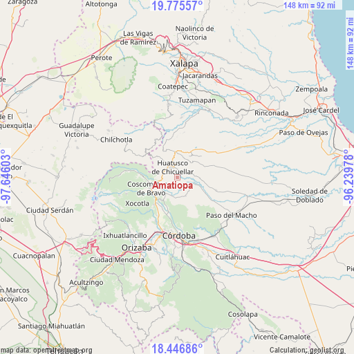
Amatiopa GPS coordinates[2]
19° 6' 45.18" North, 96° 56' 34.44" West
| Map corner | latitude | longitude |
|---|---|---|
| Upper-left | 19.77557°, | -97.64603° |
| Center: | 19.11255°, | -96.9429° |
| Lower-right: | 18.44686°, | -96.23978° |
| Map W x H: | 147.7×147.7 km | = 91.8×91.8mi |
| max Lat: | 32.7° ⇑62.9% North |
| Amatiopa: | 19.11255° |
| min Lat: | ⇓37.1% South 14.53588° |
| min Long | Amatiopa | max Long |
| -117.105° | -96.9429° | -86.73105° |
| W 75.6%⇐ | ⇒24.4% E |
Elevation
Elevation of Amatiopa is 1134 m = 3720 ft, and this is 119.7 m = 393 ft below average elevation for this country.
| Max E: |
3497 m = 11473 ft | 56.6% |
| Avg. | 1253.7 m = 4113 ft | |
| Amatiopa | 1134 m = 3720 ft | |
Min E: |
-1 m = -3 ft | 43.4% |
See also: Mexico elevation on elevation.city.
Geographical zone
Amatiopa is located in North Torrid zone (between Equator and Tropic of Cancer). Distance of this Northern Tropic circle is 480.8 km =298.8 mi to North.| Distance of | km | miles | from Amatiopa |
|---|---|---|---|
| North Pole | 7881.9 | 4897.6 | to North |
| Arctic Circle | 5276.1 | 3278.4 | to North |
| Tropic Cancer | 480.8 | 298.8 | to North |
| Equator | 2125.1 | 1320.5 | to South |


Nearby cities:
15 places around Amatiopa: (largest is in red/bold)
• Adolfo Ruiz Cortines (La Pastoría)
7 km =4.3 mi,  301°
301°
• Alta Luz
3.1 km =1.9 mi,  194°
194°
• Capulapa
5.9 km =3.7 mi,  104°
104°
• Colonia Francisco I. Madero
6 km =3.7 mi,  284°
284°
• Colonia Pastoría Cuatro
6 km =3.7 mi,  314°
314°
• Huatusco
4.8 km =3 mi,  327°
327°
• Ixcatla
4.9 km =3 mi,  148°
148°
• Ixpila
2.6 km =1.6 mi, 284°
• Mesa del Rancho
1.8 km =1.1 mi,  338°
338°
• Michapa
1.4 km =0.9 mi,  235°
235°
• Presidio
5.7 km =3.5 mi,  212°
212°
• Tlaltengo
7.3 km =4.5 mi, 242°
• Tlamatoca
2.2 km =1.4 mi,  163°
163°
• Tomatlancillo
7.3 km =4.5 mi,  9°
9°
• Zacamitla
7.1 km =4.4 mi, 164°
Sources, notices
• [Note1] Compared only with cities in Mexico existing in our database
• [Src1] Map data: © OpenStreetMap contributors (CC-BY-SA)
• [Src2] Other city data from geonames.org with taken over terms of usage.
• [Src3] Geographical zone / Annual Mean Temperature by Robert A. Rohde @ Wikipedia
