Nuevo Poblado el Caracol geodata
Nuevo Poblado el Caracol (Guerrero) is a populated place; located in Mexico in America/Mexico_City (GMT-6) time zone. With population of 511 people, there are 16451 cities with bigger population in this country. Compared to other cities in Mexico, 79.1% of cities are located further ↑North; 64.3% of cities are located further →East and 70.6% of cities have higher elevation than Nuevo Poblado el Caracol. Note1
Current local time in Nuevo Poblado el Caracol:
12:31 PM, MondayDifference from your time zone: hours


Nuevo Poblado el Caracol GPS coordinates[2]
17° 57' 30.996" North, 100° 1' 21" West
| Map corner | latitude | longitude |
|---|---|---|
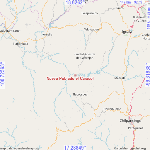
| Upper-left | 18.6262°, | -100.72563° |
| Center: | 17.95861°, | -100.0225° |
| Lower-right: | 17.28849°, | -99.31938° |
| Map W x H: | 148.7×148.7 km | = 92.4×92.4mi |
| max Lat: | 32.7° ⇑79.1% North |
| Nuevo Poblado el Caracol: | 17.95861° |
| min Lat: | ⇓20.9% South 14.53588° |
| min Long | Nuevo Poblado e | max Long |
| -117.105° | -100.0225° | -86.73105° |
| W 35.7%⇐ | ⇒64.3% E |
Elevation
Elevation of Nuevo Poblado el Caracol is 386 m = 1266 ft, and this is 867.7 m = 2847 ft below average elevation for this country.
| Max E: |
3497 m = 11473 ft | 70.6% |
| Avg. | 1253.7 m = 4113 ft | |
| Nuevo Poblado el Caracol | 386 m = 1266 ft | |
Min E: |
-1 m = -3 ft | 29.4% |
See also: Mexico elevation on elevation.city.
Geographical zone
Nuevo Poblado el Caracol is located in North Torrid zone (between Equator and Tropic of Cancer). Distance of this Northern Tropic circle is 609.1 km =378.5 mi to North.| Distance of | km | miles | from Nuevo Poblado el Caracol |
|---|---|---|---|
| North Pole | 8010.3 | 4977.4 | to North |
| Arctic Circle | 5404.4 | 3358.1 | to North |
| Tropic Cancer | 609.1 | 378.5 | to North |
| Equator | 1996.8 | 1240.8 | to South |


Nearby cities:
15 places around Nuevo Poblado el Caracol: (largest is in red/bold)
• Acatlán del Río
13.2 km =8.2 mi,  101°
101°
• Apaxtla de Castrejón
21.4 km =13.3 mi,  26°
26°
• Chichiltepec
17.4 km =10.8 mi,  194°
194°
• Cuetzala del Progreso
28.1 km =17.5 mi,  45°
45°
• Durazno del Rosario
24.9 km =15.5 mi,  205°
205°
• Huautla
14.5 km =9 mi,  215°
215°
• La Ciénega
22.1 km =13.7 mi,  134°
134°
• La Venta
20.6 km =12.8 mi,  143°
143°
• Las Vinatas
21.2 km =13.2 mi,  121°
121°
• Oxtotitlán
27.4 km =17 mi,  20°
20°
• Pericotepec
20.5 km =12.7 mi,  269°
269°
• Tlacotenco
22 km =13.7 mi,  153°
153°
• Tlacotepec
19.3 km =12 mi,  166°
166°
• Zompantle
22 km =13.7 mi,  177°
177°
• Zopilostoc
24.5 km =15.2 mi, 172°
Sources, notices
• [Note1] Compared only with cities in Mexico existing in our database
• [Src1] Map data: © OpenStreetMap contributors (CC-BY-SA)
• [Src2] Other city data from geonames.org with taken over terms of usage.
• [Src3] Geographical zone / Annual Mean Temperature by Robert A. Rohde @ Wikipedia
