Villa Emilio Carranza geodata
Villa Emilio Carranza (Veracruz) is a populated place; located in Mexico in America/Mexico_City (GMT-6) time zone. With population of 5,727 people, there are 1625 cities with bigger population in this country. Compared to other cities in Mexico, 56.4% of cities are located further ↓South; 79.1% of cities are located further ←West and 82.5% of cities have higher elevation than Villa Emilio Carranza. Note1
Current local time in Villa Emilio Carranza:
08:30 AM, WednesdayDifference from your time zone: hours


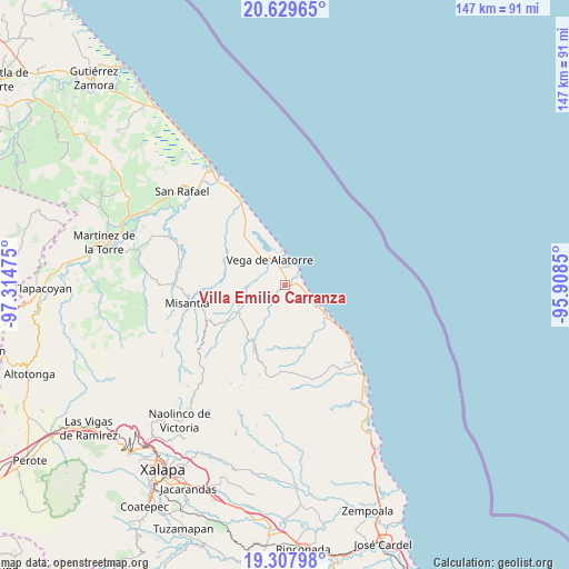
Villa Emilio Carranza GPS coordinates[2]
19° 58' 12.72" North, 96° 36' 41.832" West
| Map corner | latitude | longitude |
|---|---|---|
| Upper-left | 20.62965°, | -97.31475° |
| Center: | 19.9702°, | -96.61162° |
| Lower-right: | 19.30798°, | -95.9085° |
| Map W x H: | 147×147 km | = 91.3×91.3mi |
| max Lat: | 32.7° ⇑43.6% North |
| Villa Emilio Carranza: | 19.9702° |
| min Lat: | ⇓56.4% South 14.53588° |
| min Long | Villa Emilio Ca | max Long |
| -117.105° | -96.61162° | -86.73105° |
| W 79.1%⇐ | ⇒20.9% E |
Elevation
Elevation of Villa Emilio Carranza is 65 m = 213 ft, and this is 1188.7 m = 3900 ft below average elevation for this country.
| Max E: |
3497 m = 11473 ft | 82.5% |
| Avg. | 1253.7 m = 4113 ft | |
| Villa Emilio Carranza | 65 m = 213 ft | |
Min E: |
-1 m = -3 ft | 17.5% |
See also: Mexico elevation on elevation.city.
Geographical zone
Villa Emilio Carranza is located in North Torrid zone (between Equator and Tropic of Cancer). Distance of this Northern Tropic circle is 385.4 km =239.5 mi to North.| Distance of | km | miles | from Villa Emilio Carranza |
|---|---|---|---|
| North Pole | 7786.6 | 4838.4 | to North |
| Arctic Circle | 5180.7 | 3219.1 | to North |
| Tropic Cancer | 385.4 | 239.5 | to North |
| Equator | 2220.5 | 1379.8 | to South |


Nearby cities:
15 places around Villa Emilio Carranza: (largest is in red/bold)
• Arroyo Frío
16.1 km =10 mi,  267°
267°
• Colipa
13.2 km =8.2 mi,  246°
246°
• Cristóbal Hidalgo
20.3 km =12.6 mi,  228°
228°
• Cuautitlán del Parral
18.8 km =11.7 mi,  221°
221°
• Dos Arroyos
15.3 km =9.5 mi, 221°
• El Chaparral
11.7 km =7.3 mi,  200°
200°
• El Ciervo
18.2 km =11.3 mi,  290°
290°
• Juchique de Ferrer
16.9 km =10.5 mi,  210°
210°
• Laguna de Farfán
18.9 km =11.7 mi,  190°
190°
• Las Higueras
7.5 km =4.7 mi,  351°
351°
• Plan de la Vega
19.7 km =12.2 mi, 265°
• Santa Ana
14.1 km =8.8 mi,  128°
128°
• Vega de Alatorre
7.5 km =4.7 mi,  329°
329°
• Venustiano Carranza
21.9 km =13.6 mi, 250°
• Yecuatla
20.9 km =13 mi,  236°
236°
Sources, notices
• [Note1] Compared only with cities in Mexico existing in our database
• [Src1] Map data: © OpenStreetMap contributors (CC-BY-SA)
• [Src2] Other city data from geonames.org with taken over terms of usage.
• [Src3] Geographical zone / Annual Mean Temperature by Robert A. Rohde @ Wikipedia
