San Pedro Petlacotla geodata
San Pedro Petlacotla (Puebla) is a populated place; located in Mexico in America/Mexico_City (GMT-6) time zone. With population of 1,444 people, there are 5977 cities with bigger population in this country. Compared to other cities in Mexico, 65.9% of cities are located further ↓South; 64.7% of cities are located further ←West and 67.4% of cities have higher elevation than San Pedro Petlacotla. Note1
Current local time in San Pedro Petlacotla:
08:28 AM, WednesdayDifference from your time zone: hours


San Pedro Petlacotla GPS coordinates[2]
20° 24' 42.696" North, 97° 54' 51.948" West
| Map corner | latitude | longitude |
|---|---|---|
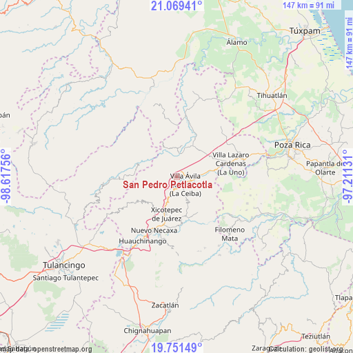
| Upper-left | 21.06941°, | -98.61756° |
| Center: | 20.41186°, | -97.91443° |
| Lower-right: | 19.75149°, | -97.21131° |
| Map W x H: | 146.5×146.5 km | = 91×91mi |
| max Lat: | 32.7° ⇑34.1% North |
| San Pedro Petlacotla: | 20.41186° |
| min Lat: | ⇓65.9% South 14.53588° |
| min Long | San Pedro Petla | max Long |
| -117.105° | -97.91443° | -86.73105° |
| W 64.7%⇐ | ⇒35.3% E |
Elevation
Elevation of San Pedro Petlacotla is 562 m = 1844 ft, and this is 691.7 m = 2269 ft below average elevation for this country.
| Max E: |
3497 m = 11473 ft | 67.4% |
| Avg. | 1253.7 m = 4113 ft | |
| San Pedro Petlacotla | 562 m = 1844 ft | |
Min E: |
-1 m = -3 ft | 32.6% |
See also: Mexico elevation on elevation.city.
Geographical zone
San Pedro Petlacotla is located in North Torrid zone (between Equator and Tropic of Cancer). Distance of this Northern Tropic circle is 336.3 km =209 mi to North.| Distance of | km | miles | from San Pedro Petlacotla |
|---|---|---|---|
| North Pole | 7737.5 | 4807.9 | to North |
| Arctic Circle | 5131.6 | 3188.6 | to North |
| Tropic Cancer | 336.3 | 209 | to North |
| Equator | 2269.6 | 1410.3 | to South |


Nearby cities:
15 places around San Pedro Petlacotla: (largest is in red/bold)
• Agua Linda
6.2 km =3.9 mi,  52°
52°
• Apapantilla
7.1 km =4.4 mi,  97°
97°
• Ejido de Jalpan
5.3 km =3.3 mi,  4°
4°
• El Rincón
9.9 km =6.2 mi,  285°
285°
• Gilberto Camacho
5.2 km =3.2 mi,  144°
144°
• Itzatlán
11.3 km =7 mi,  220°
220°
• Jalapilla
4.8 km =3 mi,  182°
182°
• Nuevo Carrizal
10.1 km =6.3 mi,  11°
11°
• Nuevo Tenancingo
1.7 km =1.1 mi,  321°
321°
• Papaloctipan
4.5 km =2.8 mi, 287°
• Plan de Ayala
2.2 km =1.4 mi,  346°
346°
• San Lorenzo
7.2 km =4.5 mi,  198°
198°
• Villa Avila Camacho
4.6 km =2.9 mi,  128°
128°
• Vista Hermosa
8.2 km =5.1 mi, 9°
• Zacatal
8.4 km =5.2 mi,  236°
236°
Sources, notices
• [Note1] Compared only with cities in Mexico existing in our database
• [Src1] Map data: © OpenStreetMap contributors (CC-BY-SA)
• [Src2] Other city data from geonames.org with taken over terms of usage.
• [Src3] Geographical zone / Annual Mean Temperature by Robert A. Rohde @ Wikipedia
