San Lorenzo geodata
San Lorenzo (Puebla) is a populated place; located in Mexico in America/Mexico_City (GMT-6) time zone. With population of 1,095 people, there are 7940 cities with bigger population in this country. Compared to other cities in Mexico, 64.5% of cities are located further ↓South; 64.4% of cities are located further ←West and 63% of cities have higher elevation than San Lorenzo. Note1


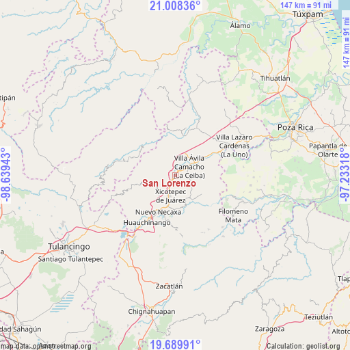
San Lorenzo GPS coordinates[2]
20° 21' 1.944" North, 97° 56' 10.68" West
| Map corner | latitude | longitude |
|---|---|---|
| Upper-left | 21.00836°, | -98.63943° |
| Center: | 20.35054°, | -97.9363° |
| Lower-right: | 19.68991°, | -97.23318° |
| Map W x H: | 146.6×146.6 km | = 91.1×91.1mi |
| max Lat: | 32.7° ⇑35.5% North |
| San Lorenzo: | 20.35054° |
| min Lat: | ⇓64.5% South 14.53588° |
| min Long | San Lorenzo | max Long |
| -117.105° | -97.9363° | -86.73105° |
| W 64.4%⇐ | ⇒35.6% E |
Elevation
Elevation of San Lorenzo is 821 m = 2694 ft, and this is 432.7 m = 1420 ft below average elevation for this country.
| Max E: |
3497 m = 11473 ft | 63% |
| Avg. | 1253.7 m = 4113 ft | |
| San Lorenzo | 821 m = 2694 ft | |
Min E: |
-1 m = -3 ft | 37% |
See also: Mexico elevation on elevation.city.
Geographical zone
San Lorenzo is located in North Torrid zone (between Equator and Tropic of Cancer). Distance of this Northern Tropic circle is 343.2 km =213.3 mi to North.| Distance of | km | miles | from San Lorenzo |
|---|---|---|---|
| North Pole | 7744.3 | 4812.1 | to North |
| Arctic Circle | 5138.4 | 3192.9 | to North |
| Tropic Cancer | 343.2 | 213.3 | to North |
| Equator | 2262.8 | 1406 | to South |


Nearby cities:
15 places around San Lorenzo: (largest is in red/bold)
• El Jericó
6.9 km =4.3 mi,  272°
272°
• Gilberto Camacho
5.9 km =3.7 mi,  64°
64°
• Itzatlán
5.3 km =3.3 mi,  250°
250°
• Jalapilla
2.9 km =1.8 mi,  46°
46°
• Lomas Verdes
9.9 km =6.2 mi,  187°
187°
• Morelos
10.2 km =6.3 mi,  183°
183°
• Nuevo Tenancingo
8.3 km =5.2 mi,  8°
8°
• Papaloctipan
8.4 km =5.2 mi,  346°
346°
• Plan de Ayala
9.1 km =5.7 mi, 11°
• San Pedro Itztla
8.4 km =5.2 mi, 178°
• San Pedro Petlacotla
7.2 km =4.5 mi,  18°
18°
• Tlaxcalantongo
7.8 km =4.8 mi,  121°
121°
• Villa Avila Camacho
7.1 km =4.4 mi, 56°
• Xicotepec de Juárez
8.7 km =5.4 mi,  197°
197°
• Zacatal
5.2 km =3.2 mi,  294°
294°
Sources, notices
• [Note1] Compared only with cities in Mexico existing in our database
• [Src1] Map data: © OpenStreetMap contributors (CC-BY-SA)
• [Src2] Other city data from geonames.org with taken over terms of usage.
• [Src3] Geographical zone / Annual Mean Temperature by Robert A. Rohde @ Wikipedia
