Apapantilla geodata
Apapantilla (Puebla) is a populated place; located in Mexico in America/Mexico_City (GMT-6) time zone. With population of 2,061 people, there are 4233 cities with bigger population in this country. Compared to other cities in Mexico, 65.7% of cities are located further ↓South; 65.5% of cities are located further ←West and 74.7% of cities have higher elevation than Apapantilla. Note1


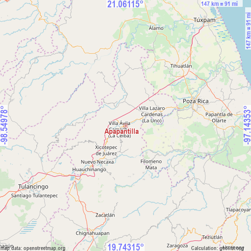
Apapantilla GPS coordinates[2]
20° 24' 12.816" North, 97° 50' 47.94" West
| Map corner | latitude | longitude |
|---|---|---|
| Upper-left | 21.06115°, | -98.54978° |
| Center: | 20.40356°, | -97.84665° |
| Lower-right: | 19.74315°, | -97.14353° |
| Map W x H: | 146.5×146.5 km | = 91×91mi |
| max Lat: | 32.7° ⇑34.3% North |
| Apapantilla: | 20.40356° |
| min Lat: | ⇓65.7% South 14.53588° |
| min Long | Apapantilla | max Long |
| -117.105° | -97.84665° | -86.73105° |
| W 65.5%⇐ | ⇒34.5% E |
Elevation
Elevation of Apapantilla is 231 m = 758 ft, and this is 1022.7 m = 3355 ft below average elevation for this country.
| Max E: |
3497 m = 11473 ft | 74.7% |
| Avg. | 1253.7 m = 4113 ft | |
| Apapantilla | 231 m = 758 ft | |
Min E: |
-1 m = -3 ft | 25.3% |
See also: Mexico elevation on elevation.city.
Geographical zone
Apapantilla is located in North Torrid zone (between Equator and Tropic of Cancer). Distance of this Northern Tropic circle is 337.3 km =209.6 mi to North.| Distance of | km | miles | from Apapantilla |
|---|---|---|---|
| North Pole | 7738.4 | 4808.4 | to North |
| Arctic Circle | 5132.5 | 3189.2 | to North |
| Tropic Cancer | 337.3 | 209.6 | to North |
| Equator | 2268.7 | 1409.7 | to South |


Nearby cities:
15 places around Apapantilla: (largest is in red/bold)
• Agua Linda
5.1 km =3.2 mi,  335°
335°
• Ejido de Jalpan
9.1 km =5.7 mi,  312°
312°
• El Tepetate
6.8 km =4.2 mi,  67°
67°
• Gilberto Camacho
5.2 km =3.2 mi,  230°
230°
• Jalapilla
8.2 km =5.1 mi,  241°
241°
• La Palma
9.8 km =6.1 mi,  85°
85°
• Nuevo Tenancingo
8.5 km =5.3 mi,  285°
285°
• Nuevo Zoquiapan
9.7 km =6 mi, 66°
• Piedras Negras
9.8 km =6.1 mi,  64°
64°
• Plan de Ayala
8.2 km =5.1 mi, 292°
• San Pedro Petlacotla
7.1 km =4.4 mi,  277°
277°
• Santa Rita
5.4 km =3.4 mi,  144°
144°
• Tlaxcalantongo
10.3 km =6.4 mi,  194°
194°
• Villa Avila Camacho
4 km =2.5 mi, 240°
• Vista Hermosa
10.7 km =6.6 mi,  327°
327°
Sources, notices
• [Note1] Compared only with cities in Mexico existing in our database
• [Src1] Map data: © OpenStreetMap contributors (CC-BY-SA)
• [Src2] Other city data from geonames.org with taken over terms of usage.
• [Src3] Geographical zone / Annual Mean Temperature by Robert A. Rohde @ Wikipedia
