Villa Avila Camacho geodata
Villa Avila Camacho (Puebla) is a populated place; located in Mexico in America/Mexico_City (GMT-6) time zone. With population of 8,780 people, there are 1083 cities with bigger population in this country. Compared to other cities in Mexico, 65.3% of cities are located further ↓South; 65.1% of cities are located further ←West and 74.3% of cities have higher elevation than Villa Avila Camacho. Note1


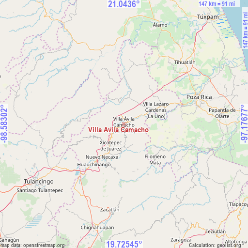
Villa Avila Camacho GPS coordinates[2]
20° 23' 9.348" North, 97° 52' 47.604" West
| Map corner | latitude | longitude |
|---|---|---|
| Upper-left | 21.0436°, | -98.58302° |
| Center: | 20.38593°, | -97.87989° |
| Lower-right: | 19.72545°, | -97.17677° |
| Map W x H: | 146.6×146.6 km | = 91.1×91.1mi |
| max Lat: | 32.7° ⇑34.7% North |
| Villa Avila Camacho: | 20.38593° |
| min Lat: | ⇓65.3% South 14.53588° |
| min Long | Villa Avila Cam | max Long |
| -117.105° | -97.87989° | -86.73105° |
| W 65.1%⇐ | ⇒34.9% E |
Elevation
Elevation of Villa Avila Camacho is 244 m = 801 ft, and this is 1009.7 m = 3313 ft below average elevation for this country.
| Max E: |
3497 m = 11473 ft | 74.3% |
| Avg. | 1253.7 m = 4113 ft | |
| Villa Avila Camacho | 244 m = 801 ft | |
Min E: |
-1 m = -3 ft | 25.7% |
See also: Mexico elevation on elevation.city.
Geographical zone
Villa Avila Camacho is located in North Torrid zone (between Equator and Tropic of Cancer). Distance of this Northern Tropic circle is 339.2 km =210.8 mi to North.| Distance of | km | miles | from Villa Avila Camacho |
|---|---|---|---|
| North Pole | 7740.4 | 4809.7 | to North |
| Arctic Circle | 5134.5 | 3190.4 | to North |
| Tropic Cancer | 339.2 | 210.8 | to North |
| Equator | 2266.7 | 1408.5 | to South |


Nearby cities:
15 places around Villa Avila Camacho: (largest is in red/bold)
• Agua Linda
6.8 km =4.2 mi,  11°
11°
• Apapantilla
4 km =2.5 mi,  60°
60°
• Ejido de Jalpan
8.8 km =5.5 mi,  338°
338°
• El Tepetate
10.8 km =6.7 mi, 64°
• Gilberto Camacho
1.5 km =0.9 mi,  203°
203°
• Jalapilla
4.3 km =2.7 mi,  242°
242°
• Nuevo Tenancingo
6.3 km =3.9 mi,  312°
312°
• Papaloctipan
8.9 km =5.5 mi,  298°
298°
• Plan de Ayala
6.5 km =4 mi,  320°
320°
• San Lorenzo
7.1 km =4.4 mi, 236°
• San Pedro Petlacotla
4.6 km =2.9 mi, 308°
• Santa Rita
7 km =4.3 mi,  110°
110°
• Tlaxcalantongo
8 km =5 mi,  174°
174°
• Vista Hermosa
11.2 km =7 mi,  348°
348°
• Zacatal
10.7 km =6.6 mi,  260°
260°
Sources, notices
• [Note1] Compared only with cities in Mexico existing in our database
• [Src1] Map data: © OpenStreetMap contributors (CC-BY-SA)
• [Src2] Other city data from geonames.org with taken over terms of usage.
• [Src3] Geographical zone / Annual Mean Temperature by Robert A. Rohde @ Wikipedia
