Zacatal geodata
Zacatal (Puebla) is a populated place; located in Mexico in America/Mexico_City (GMT-6) time zone. With population of 768 people, there are 11396 cities with bigger population in this country. Compared to other cities in Mexico, 65% of cities are located further ↓South; 63.8% of cities are located further ←West and 64.7% of cities have higher elevation than Zacatal. Note1


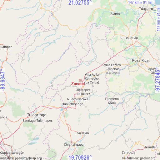
Zacatal GPS coordinates[2]
20° 22' 11.316" North, 97° 58' 53.652" West
| Map corner | latitude | longitude |
|---|---|---|
| Upper-left | 21.02755°, | -98.6847° |
| Center: | 20.36981°, | -97.98157° |
| Lower-right: | 19.70926°, | -97.27845° |
| Map W x H: | 146.6×146.6 km | = 91.1×91.1mi |
| max Lat: | 32.7° ⇑35% North |
| Zacatal: | 20.36981° |
| min Lat: | ⇓65% South 14.53588° |
| min Long | Zacatal | max Long |
| -117.105° | -97.98157° | -86.73105° |
| W 63.8%⇐ | ⇒36.2% E |
Elevation
Elevation of Zacatal is 705 m = 2313 ft, and this is 548.7 m = 1800 ft below average elevation for this country.
| Max E: |
3497 m = 11473 ft | 64.7% |
| Avg. | 1253.7 m = 4113 ft | |
| Zacatal | 705 m = 2313 ft | |
Min E: |
-1 m = -3 ft | 35.3% |
See also: Mexico elevation on elevation.city.
Geographical zone
Zacatal is located in North Torrid zone (between Equator and Tropic of Cancer). Distance of this Northern Tropic circle is 341 km =211.9 mi to North.| Distance of | km | miles | from Zacatal |
|---|---|---|---|
| North Pole | 7742.2 | 4810.8 | to North |
| Arctic Circle | 5136.3 | 3191.5 | to North |
| Tropic Cancer | 341 | 211.9 | to North |
| Equator | 2264.9 | 1407.3 | to South |


Nearby cities:
15 places around Zacatal: (largest is in red/bold)
• Cuautepec
7.2 km =4.5 mi,  241°
241°
• Cuaxtla
9.5 km =5.9 mi,  272°
272°
• El Jericó
2.9 km =1.8 mi,  228°
228°
• El Rincón
7.7 km =4.8 mi,  340°
340°
• El Álamo
6.3 km =3.9 mi, 274°
• Itzatlán
3.9 km =2.4 mi,  184°
184°
• Jalapilla
6.8 km =4.2 mi,  91°
91°
• Nuevo Tenancingo
8.5 km =5.3 mi,  44°
44°
• Papaloctipan
6.6 km =4.1 mi,  24°
24°
• Plan de Ayala
9.4 km =5.8 mi, 43°
• San Lorenzo
5.2 km =3.2 mi,  114°
114°
• San Pedro Petlacotla
8.4 km =5.2 mi,  56°
56°
• Santa María
9.7 km =6 mi, 231°
• Tlapehuala
8 km =5 mi,  217°
217°
• Tlaxco
7.8 km =4.8 mi,  320°
320°
Sources, notices
• [Note1] Compared only with cities in Mexico existing in our database
• [Src1] Map data: © OpenStreetMap contributors (CC-BY-SA)
• [Src2] Other city data from geonames.org with taken over terms of usage.
• [Src3] Geographical zone / Annual Mean Temperature by Robert A. Rohde @ Wikipedia
